The GIS Centre in Dubai Municipality develops system for classifying Dubai assets
Initiative simplifies the asset assessment operations of various entities in the emirate
Also In This Package


Dubai: The GIS (global information systems) Centre in Dubai Municipality has developed an integrated system for classifying Dubai assets in a comprehensive geospatial dictionary.
The move comes within the framework of the directives of Sheikh Hamdan bin Mohammed bin Rashid Al Maktoum, Crown Prince of Dubai and chairman of the Executive Council, to transform the Government of Dubai into a fully smart model and make Dubai the address of smart cities in the world.
It is also in implementation of the GIS Centre’s tasks’ related to collecting the emirate’s basic and detailed geographic data and digital information, including descriptive ones, classifying this data and information, setting technical controls with the asset owners, and then providing geographical data, information and a dictionary to it within the limits of agreements and memoranda of understanding concluded between the centre and the owners of these assets, data and information.

Successive stages
Maryam Al Muhairi, director of GIS Centre, said: “The system for classifying Dubai asset in a comprehensive geospatial dictionary goes through many stages. The first stage is the unification of asset classification standards, through which the standards for classifying assets are unified in the comprehensive basemap with a focus on the geographical aspect to list the data of fixed-location assets.
“The second stage is to build a comprehensive geospatial database for assets and then update the comprehensive basemap database model with a focus on assets by geographical aspect,” she said.
“The third stage is to collect the asset locations and information that are unavailable. Through the initiative, a field survey was conducted to collect and confirm the spatial accuracy of the Municipality’s assets, followed by the assets of other parties, using all available means for field work, whether traditional or modern, using drones and geospatial photography car of the centre,” added Al Muhairi.
The fourth stage is the development of the electronic geospatial dictionary of assets, as the comprehensive geospatial dictionary is an integral part of the integrated system for classifying Dubai assets in a geospatial dictionary, she explained.
“The fifth stage is the electronic components of the geospatial dictionary of assets, which in turn is divided into the display browser. It is the browser through which the assets created in the dictionary are displayed, which have been indexed in a way that makes it easier for the user to access the required information,” she added.
Search engine
Al Muhairi said the system contains a search engine that helps the user to access any item or detailed data available within the centre and available automatically in the system.
The Update App is the application through which the new or existing assets in the dictionary are updated. It is used by the geospatial dictionary staff, to add, modify or delete any detailed stage of the data in addition to the accompanying images according to the modification in the geospatial database.
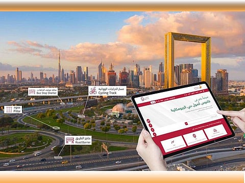
Dubai’s assets and its dictionary are displayed through the “Dubai Here” system, which was developed by the GIS Centre as a comprehensive portal for displaying and analysing the geospatial statistics data.
Classifying Dubai’s assets in a comprehensive geospatial dictionary, plays an essential role in listing Dubai’s assets geospatially and gives an added value to the assets. It also simplifies the asset assessment operations of various entities in the event of modification, change or establishment of new projects that must be removed or modified while studying the feasibility of the related projects.


