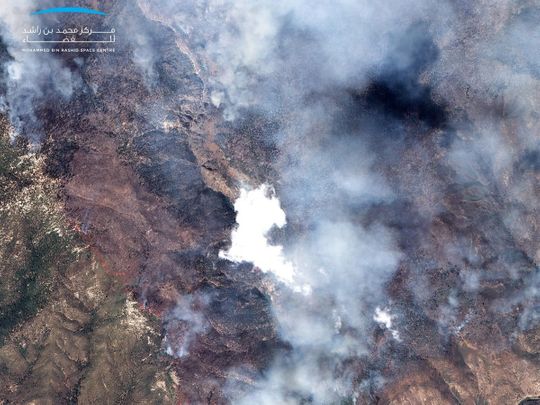
Dubai: UAE-built KhalifaSat, a remote sensing Earth observation satellite, on Thursday released an image captured from space showing the impact of wildfires rampaging Northern and Central California, USA.
Since August 15, the US state has experienced more than 650 wildfires, mostly sparked by lightning, that have burnt down more than 1.25 million acres of land. The total area is six times bigger the size of New York City and the fires have left at least seven people dead and destroyed more than 1,400 buildings, according to reports.
KhalifaSat, developed by the Mohammed Bin Rashid Space Centre (MBRSC) in Dubai and launched in October 2018, took high-resolution detailed images to help governments and private sectors get accurate data and allow them to monitor environmental changes.
The MBRSC said the images taken by KhalifaSat detect the effects of global warming, ensure responsible urban planning and management, and aid relief efforts at times of natural disasters.


