Tropical Storm "Mitag" intensified from a tropical storm into a severe tropical storm.
It continued moving over the Philippine Sea, slightly accelerating before dawn on Sunday, September 29, according to Philippine weathermen.
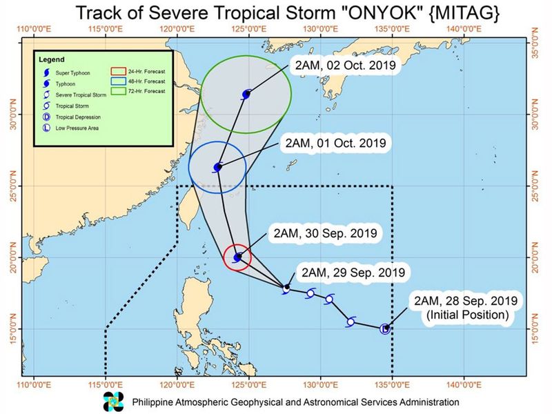
In a 5 am bulletin on Sunday, the Philippine Atmospheric, Geophysical, and Astronomical Services Administration (Pag-asa) said "Mitag", locally known as "Onyok", now has maximum winds of 95 kilometers per hour (km/h) from the previous 85 km/h and gustiness of up to 115 km/h from the previous 105 km/h.
"Mitag" might strengthen further into a typhoon within 24 hours. It was spotted at 605 kilometers east of Tuguegarao City, Cagayan, moving west at a slightly faster clip of 30 km/h, from the previous 25 km/h.
Mitag is not expected to make landfall in the Philippines. Signal No. 1 (winds of 30 km/h to 60 km/h) remains raised in Batanes and Babuyan Group of Islands.
Pag-asa added that Mitag's trough or extension will continue to trigger scattered rainshowers and thunderstorms, ranging from light to moderate.
Regions affected from Sunday morning, September 29, to Monday morning, September 30 are Cagayan Valley and Bicol.
The rest of the country will only have isolated rainshowers or localized thunderstorms on Sunday.
Lorenzo, now a Category 5 Hurricane:
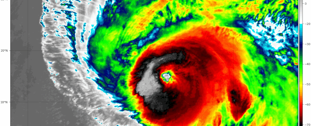
Hurricane Lorenzo, in the far easter Atlantic, has become "one of the largest and most powerful hurricanes of record for the tropical central Atlantic," according to the US National Hurricane Center.
Lorenzo has hit Cat 5 — the eastern-most storm on record to do that. It'll accelerate north-east and weaken, brushing Azores on Tuesday night and ramming British Isles Thursday night as strong post-tropical cyclone — possibly with hurricane-force gusts.
People in Ireland and United Kingdom are advised to watch this hurricane.
Lorenzo became a Category 4 storm on Thursday (with 140 mph winds) farther east than any other previous storm on record, save for Julia in 2010.
It has rapidly intensified to hit Category 5 on Sunday.
While far from any populous land masses at the moment, Lorenzo could be having an impact on the Azores in less than a week's time — all the while marking a potentially ominous climate signal.
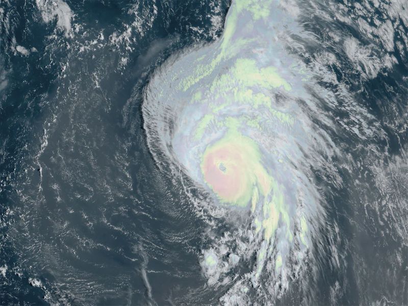
The Category 4's sprawling cloud shield spans more than 1,000 miles — roughly the distance from Washington, D.C., to Miami; including its outflow, it would be large enough to cover the entire East Coast beneath overcast.
Lorenzo had the makings of a top-tier storm from the start. The National Hurricane Center delineated it as an area to watch, with a "likely" chance of development, even while it was still a mere tropical wave over the African continent.
Lorenzo quickly bloomed immediately after exiting the African coast for the tropical Atlantic Ocean, becoming a tropical storm around lunchtime Monday. Its rate of strengthening has been notable.