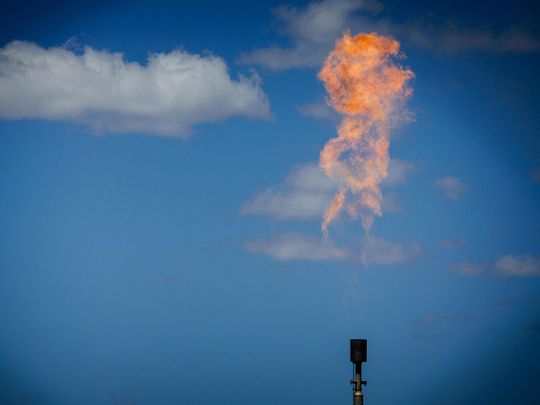
Think of them as speed cameras, but for methane. Just like roadside instruments used to identify drivers breaking traffic rules, new powerful satellites are starting to catch oil and gas operators releasing the planet-warming gas into the atmosphere.
At least two dozen high-resolution satellites are expected to be in orbit by the end of this year, quietly tracking the super pollutant that's invisible to the naked eye. Their sensors are able to detect the natural gas component as it spews from pipelines, unlit flares, storage tanks and compressor stations around the world. The images sent back are crystal clear and leave little doubt about who is responsible for leaks.
Commercial and state interests are driving an acceleration in satellite launches at a time when fossil fuel companies face investor pressure to quantify and slash their emissions, and governments intent on meeting global climate targets seek to benchmark progress. The satellite missions include public and private efforts and are poised to deliver climate transparency on a scale never before seen.
"There's been strong demand for facility-level information on emissions because it's directly actionable,'' said Daniel Varon, a postdoctoral researcher studying atmospheric composition and satellite remote sensing at Harvard University. Varon and peers published an overview of how high- and low-resolution satellites are used to track methane last year.
Methane has more than 80 times the warming power of carbon dioxide during its first two decades in the atmosphere. Halting emissions of the greenhouse gas could do more to slow climate change in the near-term than almost any other single measure.
While fines and enforcement vary, companies increasingly face reputational risks and potential loss of business if their operations are seen as contributing more than peers to the climate crisis. In the US, the world's largest oil and gas producer, the Biden administration is hammering out new rules that would empower private citizens to police oil wells and gas pipelines for leaks using information such as satellite data.
So far this year, at least three high-resolution satellites have launched, and four more are expected to enter orbit before 2024. Much of the demand for the data is coming from oil and gas operators themselves, who are increasingly using the systems to identify leaks along thousands of miles of pipeline or remote facilities. GHGSat Inc., a private company that has worked with operators, including Royal Dutch Shell Plc, Chevron Corp. and TotalEnergies SE to detect leaks, made about a million facility measurements last year and is on track to double that in 2023. The company launched three new satellites in April and plans to have three more in orbit before the end of the year.
How methane is detected from space
Satellites observe concentrations of methane from space by analyzing the way sunlight reflects off the Earth. As light passes through a cloud of the gas, its intensity is weakened on certain wavelengths. Methane absorbs light in the short-wave infrared portion of the electromagnetic spectrum.
Firms, including GHGSat and Carbon Mapper, a non-profit working with partners including Planet Labs PBC, are launching satellites designed specifically to detect methane. But much of the new high-resolution imagery is the result of data processing innovations that leverage observations from public satellites that weren't explicitly built to observe the greenhouse gas yet have spectral bands that include the short-wave infrared.
For instance, NASA's Jet Propulsion Laboratory and the California Institute of Technology's EMIT instrument was designed to help understand how giant dust clouds may heat or cool the atmosphere, but it turns out its imaging spectrometer is also able to detect concentrations of methane. The sensor was installed on the International Space Station in July last year and began releasing data through its public portal in February.
The methane observations are exposing flaws in decades-old reporting approaches used by companies and government agencies that have typically underestimated emissions. In the US, for instance, methane emissions from oil and gas operations exceeded amounts reported by the Environmental Protection Agency by 70% between 2010 and 2019, an analysis of satellite data published this month showed.
The detections are also empowering regulators and the public. New Mexico officials said in March they were inspecting any methane plumes detected by NASA and other entities and would use the data to evaluate reporting and compliance by operators.
Bloomberg Green has used high-resolution satellite data from EMIT, Landsat and Sentinel-2 satellites to report on previously unreported methane emission events in the US. Here's a short synopsis of what happened:
Operator: Exxon Mobil
Location: New Mexico
What happened: A methane release was observed by satellite Feb. 5 near the company's Big Eddy Unit 156 that Exxon failed to initially disclose to state officials. After Bloomberg shared the imagery with Exxon Feb. 24 and the company notified state regulators within hours. Exxon blamed the omission on human error and said someone forgot to file a form.
Operator: Targa Resources
Location: Texas
What happened: A methane plume was detected by satellite Jan. 20 near a Targa compressor station. Bloomberg shared satellite imagery of the release with Targa Feb. 3 and the company notified state regulators within eight hours of an emissions event. Texas is investigating why the release wasn't reported within 24 hours as required under state rules.
Operator: APA Corp.
Location: New Mexico
What happened: A methane concentration was spotted by satellite on Dec. 24. Bloomberg shared the satellite imagery with the company Jan. 12 and APA said in a subsequently filed excess emissions report that it discovered a release in a later investigation. New Mexico authorities said they weren't aware of the methane plume before being contacted by Bloomberg.
Operator: Tallgrass Energy
Location: Wyoming
What happened: Multiple satellites observed a plume that geospatial scientists with the United Nations said was nearly 5 miles long. The timing and location of the release matched a report from Tallgrass, which said it vented about 2.1 metric tons of methane in five separate safety releases. The UN's International Methane Emissions Observatory said it was "highly unlikely the volume reported by the operator could account for the emissions rate observed by the satellite.''
Although operators are incentivized to cap methane leaks because it means they have more product to sell, in the short term that often means more investment and extended downtime to change out equipment like valves or pneumatic pumps. Except for very rare emergency instances when a release may be needed to avoid a pressure build-up that could trigger an explosion, almost all deliberate emissions are avoidable and operators should have a zero-tolerance policy, according to the International Energy Agency.
But many operators still justify intentional releases or say it's impractical to halt them.
This year could see a wave of new reports on operator leaks, as new orbitals increase the coverage and frequency of observations. For operators unable to halt their emissions, that may mean a loss of credibility, fees or trouble insuring future projects. Insurer Chubb Ltd. said in March that to underwrite new oil and gas extraction projects clients would need to implement "evidence-based plans" to manage methane releases.
The most effective approach to mitigating global emissions, scientists say, is to combine high- and low-resolution satellite systems with aerial surveys and on-the-ground sensors to provide operators, governments and the public with near real-time observations of methane.
Existing satellites "are demonstrating that one can pinpoint methane emissions to individual facilities and pieces of equipment and provide enough confidence that there's a real emission source,'' said Riley Duren, chief executive officer of Carbon Mapper. The non-profit has received funding from Bloomberg Philanthropies, the charitable organization founded by Michael Bloomberg, founder and majority owner of Bloomberg News parent company Bloomberg LP.
Duren said methane tracking deserves comprehensive long-term government funding in order to build out and maintain a system as powerful and effective as weather satellites today. "There's still some work to be done as a society to prioritize and capitalize these systems if we really want to get the most out of them,'' he said.


_resources1_16a30b3523c_small.jpg)

