Engineers recall tense moments during KhalifaSat launch
‘Just 250 seconds before the launch, I and my colleagues had to decide to push the launch button’
Dubai: The KhalifaSat overcame all challenges before and during launch last week — including a super typhoon that surprisingly changed its path – paving the way for the successful launch of the UAE’s first all-Emirati-made satellite.
Emirati engineers from the Mohammad Bin Rashid Space (MBRSC), who worked on KhalifaSat project, on Monday shared their nerve-wracking experiences while building the satellite and moments before, during, and after its launch on October 29.
The UAE’s third Earth imaging satellite was successfully launched from the Tanegashima Space Centre, an island to the south of Japan last week.
But five days prior to the launch, Japan, the Philippines and Taiwan were bracing for a Category 5 super typhoon, Yutu, the strongest to hit that region in years.
Super typhoon Yutu on October 24 devastated the Northern Mariana Islands of Saipan, just 2,250km from Tanegashima Island.
This was crucial because one of many considerations for a rocket launch is the weather. Before scheduled lift offs, a Go/No-Go decision has to be made by all teams to proceed with the launch.
“Alhamdulillah, it went past Tanegashima and went [on a different path]. So the team decided to ‘Go’ on the weather,” Abdullah Harmoul, launch manager of KhalifaSat, said.
Moment of truth
After conducting all checks, the moment of truth came.
“Just 250 seconds before the launch, I and my colleagues had to decide to push the launch button assigned to MBRSC. But just the pressure of knowing that we had to push the button gave me goosebumps,” Harmoul said.
“We were sure we could launch, but when you’re actually there in the moment, [it looked surreal], I can’t even express it. So I contacted my colleagues here in the UAE and the team, and we all agreed to press the button and we did.”
“That was a proud moment for all of us. This is the fruit of our 12 years of labour. At that moment, we had a flash back of all our hard work through the years,” Harmoul said.
During one of the tests a few months back, one of the delicate hinges connecting the deployable solar panel to the satellite broke. But thankfully this happened to the engineering model and not the flight model and the issue was resolved immediately.
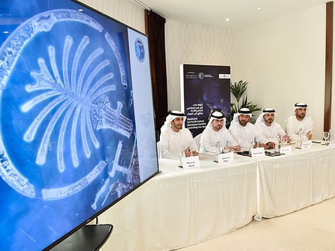
First image
The first image captured by the KhalifaSat also had a story, said Ammar Al Muhairi, Manager of the Image Processing Section.
The first two test shots of Dubai were of the Arabian Gulf and the World Islands but they were not processed as they did not meet the imaging criteria.
But when an image of the Palm Jumeirah was beamed back, it made the cut.
Al Muhairi said MBRSC can start providing customers with the first images from the KhalifaSat in the beginning of 2019.
Moving forward, Adnan Al Rais, who headed the ground station on the day of the launch, said the KhalifaSat will meet rising demand for Earth imaging on a timely fashion. The centre has received many requests for data from the KhalifaSat and they expect to meet this demand, especially from UAE entities, next year.
Hope Probe: Off to Mars in 2020
After the successful launch, the KhalifaSat team who worked on the satellite will then work on the Hope Probe, the UAE’s first space exploration of Mars due for launch in July 2020, ensuring knowledge transfer and seamless work on another historic milestone for the country.
“A very key achievement for us was made in space last week but the biggest achievement was here on Earth. This team has started to share the knowledge with the first blood of new engineers joining MBRSC. This is where we believe we achieved the target of having a sustainable space programme for UAE,” Amer Al Sayegh, KhalifaSat project manager, said.
How will the KhalifaSat’s images be used?
Meera Al Shamsi, head of remote sensing unit, said the images can be used for environmental monitoring to check percentage changes in water levels, vegetation, and disaster monitoring and management in cases of oil spills, forest fires, earthquakes, algae blooms and floods.


