The world is full of bizarre, weird places, and there’s no better way to take a closer look than through Google Earth.
Click start to play today’s Spell It, and head to Google Earth, where you can travel around the world without a ‘visa’.
By compiling images from various sources, like satellites in geosynchronous orbit or aeroplanes and drones, Google Earth’s software is able to provide extensive geological insight into the world around us. It’s an excellent resource for both students and professionals, and the best part is that it’s available to everyone, for free.
We took a deep dive into this virtual mirror of our world, and found some strange sights. Here are a few to note:
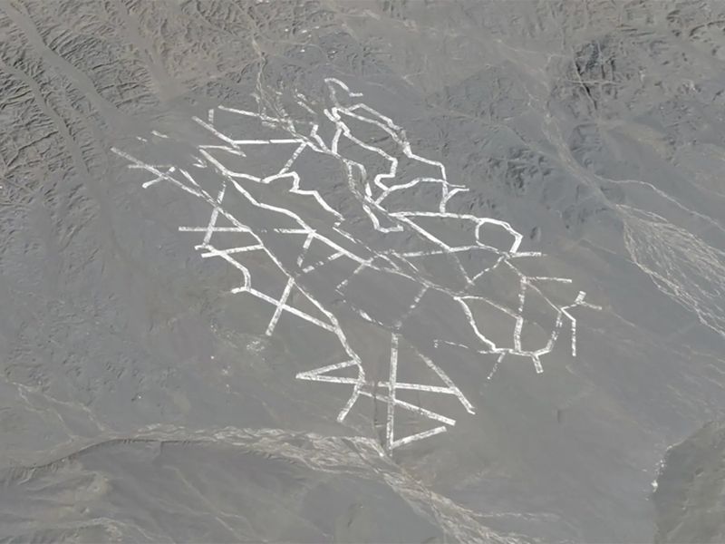
1. Swastika geoglyph
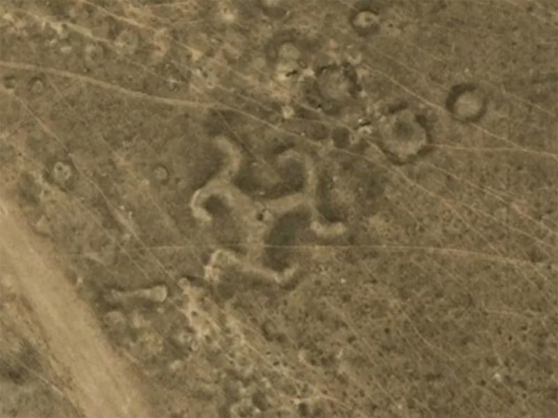
Across northern Kazakhstan in Central Asia, scientists have discovered more than 50 geoglyphs, including one that’s designed in the shape of a swastika. The symbol dates back over 2,000 years. At the time, swastikas weren’t affiliated with any political beliefs, rather they were common symbols that depicted infinity or continuing creation.
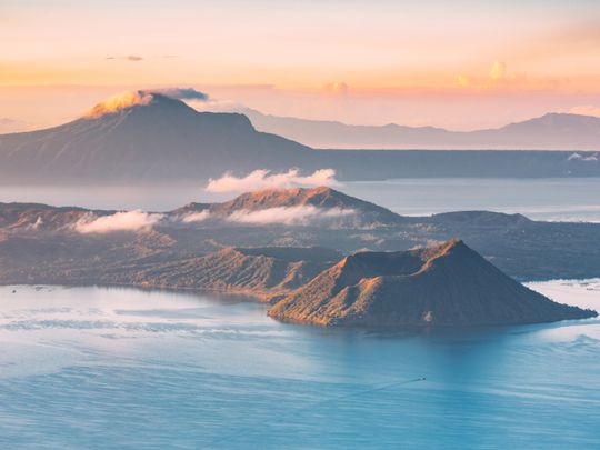
2. Volcano Island
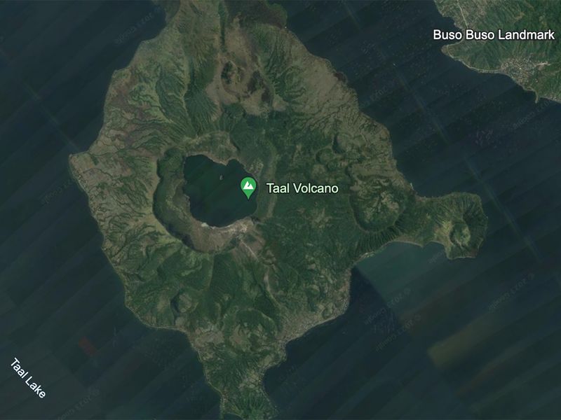
Both an 'eyeful' and a mouthful, this image captures an island in a lake on an island in a lake on an island! In other words, it’s a tiny island that resides inside a crater lake on Volcano Island, in a larger lake called Taal Lake on the Philippines island of Luzon.
3. Azraq Oasis
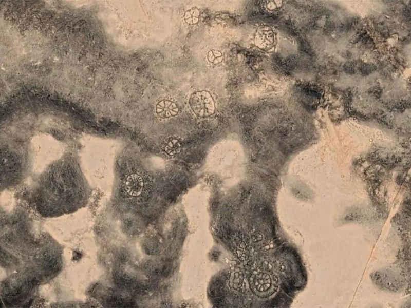
Ancient artistry that dates back some 8,500 years, is visible at Azraq Oasis in Jordan. The region is home to wheel-shaped geographic structures that are even older than Peru’s Nazca Lines geoglyphs. Archaeologists found that some of the spoked designs of these wheels are positioned in a way where they align with the sunrise on the winter solstice.
4. Gobi Desert grid
Etched into the surface of China’s Gobi Desert are a series of mysterious patterns. They look like an intricate grid of straight lines that weave back and forth, and stretch for about 33km. According to an October 2022 LiveScience report, researchers think it’s part of a secret military base, and the grid is most likely a Yagi antenna array, a device that’s used for weather tracking and atmospheric research.
5. Egypt art installation
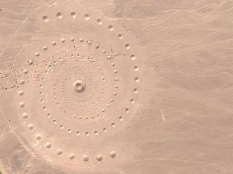
From above, it looks like a portal to another dimension. But there’s a more earthly explanation for the giant spiral design in a desolate Egyptian desert, close to the Red Sea. It’s an art installation called Desert Breath, by Greek artists Danae Stratou, Alexandra Stratou and Sella Constantinides. They created the 100,000 square metre installation in March 2007 as a way to celebrate “the desert as a state of mind, a landscape of the mind”, according to their website.
What do you think of these Google Earth discoveries? Play today’s Spell It and tell us at games@gulfnews.com.