Dubai Police demonstrate an AI-powered mapping system to guide patrols to emergencies.
Dubai Police use AI maps to send patrols to emergencies faster
AI platform tracks live incidents, identifies hotspots and guides patrols to emergencies.
Last updated:
4 MIN READ
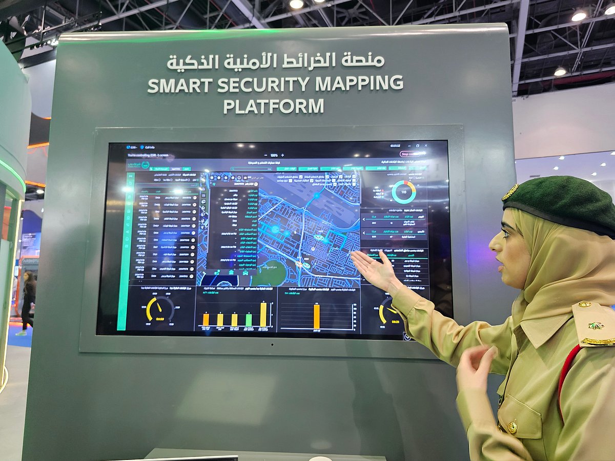
Dubai Police demonstrate an AI-powered mapping system to guide patrols to emergencies.
Aghaddir Ali/Gulf News
Dubai: Dubai Police are using artificial intelligence to pinpoint emergencies, identify crime hotspots and direct patrols along the fastest routes, helping officers cut response times and deploy resources more efficiently across the emirate.
The AI-powered Smart Security Mapping Platform tracks emergency reports in real time, pinpoints incident locations and recommends the quickest routes and strategic positions for patrol vehicles. It can also suggest changes to patrol coverage areas, allowing neighbouring units to step in when designated patrols are occupied with other incidents.
The technology was showcased at the fifth World Police Summit 2026 at Dubai World Trade Centre, where Gulf News saw a live demonstration of the system used by Dubai Police operations teams.
Get updated faster and for FREE: Download the Gulf News app now - simply click here.
Lieutenant Hessa Al Muhairi, who demonstrated the platform, said it was connected directly to Dubai Police's operations room, allowing visitors to see incoming emergency reports as they appeared in real time.
“These are live reports,” she said, pointing to incidents appearing on the digital map, with timestamps reflecting the time they were received.
Powered by Geographic Information System (GIS) technology from global mapping company Esri, the platform combines live incident reports, location data and AI-powered geographical analysis to help police operators identify emergencies, recommend patrol routes and make faster, more accurate deployment decisions.
AI identifies emergencies and recommends fastest routes
Dubai Police are turning live emergency reports into rapid patrol deployments, using artificial intelligence to pinpoint incidents, calculate the fastest routes and redirect officers to areas where they are needed most.
The AI-powered system analyses traffic conditions, road access and patrol availability to help officers reach emergencies faster, identify crime hotspots and maintain security coverage across the emirate.
The technology supports Dubai Police's three-minute emergency response target by helping operators identify the fastest routes, taking into account road access, traffic density and the availability of nearby patrols.
During Gulf News' visit, the platform displayed live reports covering a range of incidents, including residential burglaries, vehicle thefts, thefts from trucks, fuel and gas leaks, fights and other security offences.
Operators can access daily statistics to track incoming reports, analyse their geographical distribution and identify recurring incidents. During the demonstration, Al Muhairi highlighted fuel-leak reports received that day, showing how officers could retrieve individual cases and pinpoint their exact locations.
AI identifies crime hotspots and redistributes patrols
Beyond directing patrols to emergencies, the platform helps Dubai Police identify crime hotspots by analysing patterns of repeated offences and planning targeted preventive measures.
For example, if fights are repeatedly reported in a particular area, officers can examine the frequency and locations of incidents, identify recurring patterns and develop targeted security plans, including deploying additional patrols. The same approach is used to tackle repeated thefts and other offences, helping police address potential problems, prevent further incidents and stop situations from escalating.
The system also helps maintain coverage when a patrol is already attending an incident and another emergency is reported within its assigned area.
Operators can adjust geographical boundaries and divide the affected zone into smaller sections, allowing neighbouring patrols to step in and respond. This helps prevent gaps in coverage and ensures that new emergencies can be handled while the designated patrol is occupied.
Colour-coded indicators provide an immediate overview of patrol availability and operational status, helping operators identify available units and redistribute resources where they are most needed.
Five years of data help improve response times
The platform uses approximately five years of operational data to assess police performance, monitor patrol response times and improve resource allocation.
Key indicators include how quickly patrols reach incidents and how long officers spend handling cases at different locations. By analysing these figures alongside the nature, urgency and geographical distribution of reports, operations teams can identify areas for improvement and make more effective deployment decisions.
Al Muhairi said the platform had been operational for around seven years and had undergone continuous upgrades. Initially developed to help operations teams direct patrols between locations, it has evolved into an advanced system incorporating artificial intelligence, geographical analysis and drone support.
Police drones assigned dedicated coverage areas
The platform also extends to police drones, each assigned a specific geographical area to monitor, much like ground patrols. Al Muhairi said mapping drone operations alongside vehicle patrols gives police operations teams a real-time overview of security coverage and resource distribution across the emirate.
The latest AI-powered features, introduced just days before the summit, include automated recommendations for patrol routes and deployment positions, as well as adjustments to coverage areas when high-priority emergencies are reported.
Al Muhairi said further upgrades were planned to improve operational efficiency, optimise resource deployment and support faster, more accurate decision-making.
Four-member team developed the platform
The Smart Security Mapping Platform was created and developed by a specialist four-member Dubai Police team, including Lieutenant Hessa Al Muhairi.
The team built the programme using GIS technology and continues to manage and enhance it, introducing new AI capabilities and geographical analysis to help improve patrol deployment and emergency response times.
Dubai Police demonstrate an AI-powered mapping system to guide patrols to emergencies.
Network Links
GN StoreAbout Gulf NewsTerms & ConditionsReach by GNSitemapContact usPrivacy PolicyGN FocusHave your sayWork with usAdvertise with usGulf News epaperPrinting Services
Download our app
© Al Nisr Publishing LLC 2026. All rights reserved.