Without Google Maps, many of us would be perennially lost. But maps give us more than just directions – in the past, they've been drawn up to chart the ocean floor, and even greet aliens!
Click start to play today’s Crossword, where ‘map’ is the answer to one of the clues.
The oldest map known to man is from ancient Rome, in the third century. But since then, cartographers have gone above and beyond, using maps for inventive, unique missions.
One such person was Marie Tharp, an American geologist and oceanographer, who produced one of the world’s first maps of the ocean’s floor. Before the 1950s, little was known about the sea floor – the assumption was that it was flat, like a plain of mud. Tharp’s research and drawings, however, revealed that the ocean floor was not flat, but full of three-dimensional land-like features – canyons, ridges and mountains.
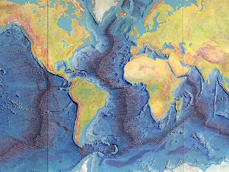
Her achievement is considered to be remarkable, firstly because it was incredibly rare to find a woman geologist in the early 20th century. Tharp was only able to go to university and study geology because World War II created a shortage of male candidates in most departments, so institutions were compelled to open their doors to women. Second, women were not allowed on boats, so Tharp could not physically voyage out to the sea when mapping the ocean floor. Still, her partnership with colleague Bruze Heezen allowed her to gather data, and create physiographic maps to make stunning depictions of the ocean floor.
From the ocean floor to the cosmos, cartographers are not limited to earthly pursuits.
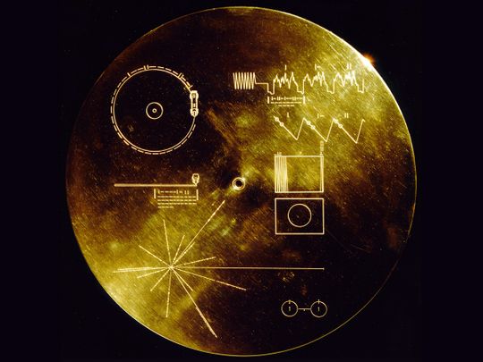
About 45 years ago, when the Voyager spacecrafts were launched as the first human-made objects to leave our solar system, US space agency National Aeronautics and Space Administration (Nasa) equipped them with a gift for any extraterrestrial life they encountered on the way.
Astronomers from the Search for Extra-Terrestrial Intelligence (Seti) Institute created a map with pulsars – remnants of supernova explosions – that are beams of light, which rotate to make specific patterns of light pulses that can be seen through a telescope. Using 14 pulsars, they emblazoned relative orientations, distances and pulse timing frequencies on the Voyager golden records – two phonograph records that also include sounds and images of life and culture on Earth.
The idea was to create a tourist map directing aliens to Earth. But while astronomers like Carl Sagan have maintained that the likelihood of someone finding the Voyager in space is very slim – just because space is so empty and the spacecraft will take decades to enter the planetary system of another star – the map remains a gesture of hope on behalf of humans.
What do you think of these unique forms of map making? Play today’s Crossword and tell us at games@gulfnews.com.