Dubai: Heavy rains hit parts of Fujairah and Ras Al Khaimah on Thursday evening, with some internal areas of Sharjah, like Khorfakkan, recording moderate to heavy rain.
Hail was reported in Mleiha, in the central region of Sharjah.
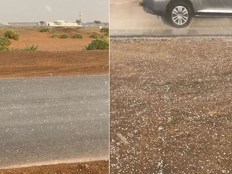
The Met Office shared videos from the affected areas and also issued a yellow and amber alert in parts of the eastern regions of the country.
According to the National Center of Meteorology (NCM), earlier today, light rainfall was reported in Al Ghail road in Ras Al Khaimah around 3pm.
Instagram page @storm_ae also shared videos of light to moderate rainfall in eastern regions.
Around 4pm, Al Dhaid in Sharjah and Masafai, Fujairah were blanketed with rainy clouds. Rain began pouring down soon after.
This morning, the lowest temperature recorded over the country is 19.7°C in Jais Mountain (Ras Al Khaimah) at 1am.
On Friday and Saturday, some rainfall is expected in the eastern and southern parts of the country, like Al Ain and Fujairah.
Strong winds and rough seas
Expect strong winds at times, especially in the areas where clouds form, to cause dust storms and reduced road visibility.
The NCM has warned motorists to watch out for sudden visibility drops during this period.
Sea conditions are expected to be moderate and rough in both the Arabian Gulf and the Oman Sea, especially when cloudy.
Tropical depression in the Arabian Sea
The NCM has issued a warning about the potential development of a tropical depression in the southern Arabian Sea, near the western coasts of India.
Based on weather maps, there is a high likelihood of a low-pressure system intensifying into a tropical depression and progressing towards the central Arabian Sea on October 14 and 15.
According to the NCM, when a tropical depression forms in the Arabian Sea, it can lead to significant weather impacts across the region, particularly in countries bordering the sea, such as UAE, Oman and parts of India, causing strong winds and heavy rainfall.
The NCM has emphasised that the accuracy of information regarding the strength of the tropical depression and its projected path will significantly improve as the system undergoes further development.
What is the difference between a tropical storm and a tropical depression?
A tropical depression forms when a low-pressure area is accompanied by thunderstorms that produce a circular wind flow with maximum sustained winds below 39 mph. An upgrade to a tropical storm occurs when cyclonic circulation becomes more organised and maximum sustained winds gust between 39 and 73 mph. Source: Nasa https://gpm.nasa.gov/resources/faq/what-difference-between-tropical-storm-and-tropical-depression
Two potential trajectories
The NCM added that there are two potential trajectories for the anticipated tropical depression. While one trajectory indicates movement west towards the central Arabian Sea and then towards the central Oman coasts, the other trajectory suggests movement west-southwest towards the central Arabian Sea and then towards Socotra.
Rapid and unforeseen changes are common due to the dynamic nature of tropical events, according to NCM weather alert.
The NCM added that it is vigilantly monitoring the situation and will provide updates on any developments unfolding.
Sign up for the Daily Briefing
Get the latest news and updates straight to your inbox
Network Links
GN StoreDownload our app
© Al Nisr Publishing LLC 2026. All rights reserved.