Philippines: Kristine intensifies into a tropical storm
Wind speed of up to 130km/h predicted as it makes landfall

Manila: Residents on the main island of Luzon and parts of the Visayas are bracing for a “direct hit” by Kristine, which has intensified into a tropical storm on Tuesday.
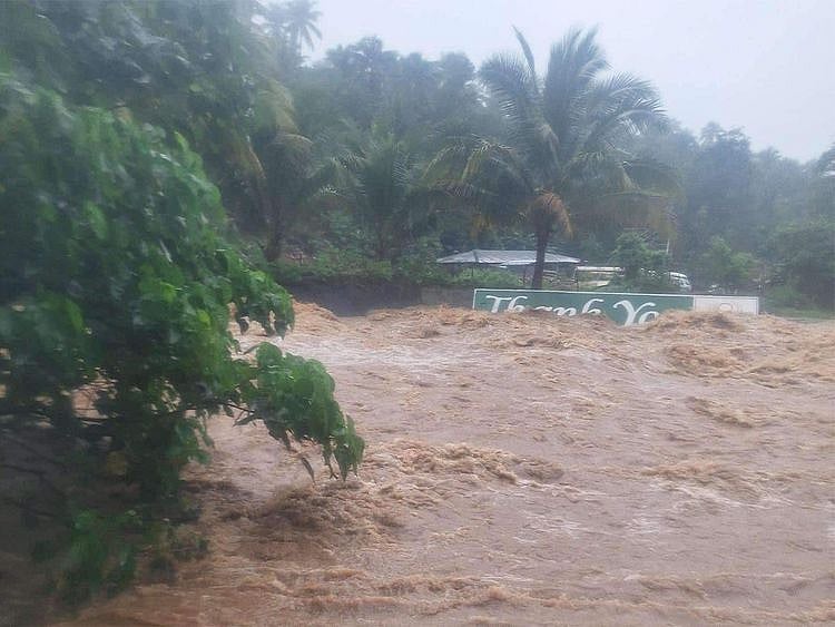
Currently moving northwest on the edge of the Pacific Ocean off the Bicol Peninsula, Kristine is dumping heavy rainfall over a wide area, potentially causing local floods and landslides.
Road travellers have reported getting stranded as at least two flooded portions of the national road have become unpassable.
Kristine's fury is set to turn further into a severe tropical storm as it makes landfall in northern Luzon.
In a 12-hour forecast for 2pm on Tuesday (October 22), the national weather bureau expects the eye of the storm at 390 km east off Daet, Camarines Norte with 75k m/h wind intensity, moving northwest.
The wind speed is expected to intensify to 130km/h as it makes landfall over the northern province of Isabela and the Ilocos region.
Emergency workers and residents in more than 5,000 barangays were urged to take necessary precautions, while fishermen were advised against going to the open sea.
The Philippine Atmospheric, Geophysical and Astronomical Services Administration (PAGASA) has issued Tropical Cyclone Bulletin No. 5 regarding Tropical Storm Kristine as of 5:00 AM on October 22, 2024.
Key points:
Tropical Storm: Kristine has intensified into a tropical storm, packing maximum sustained winds of 55 kilometers per hour (kph) near the center and gustiness of up to 70 kph.
Western movement: The storm is continuing to move northwestward at 20 km/h
Landfall threat: Kristine is forecast to make landfall over Isabela as a severe tropical storm on October 23, 2024.
Eye of the storm: The eye of the storm is expected off 145km off Delfin Albano town, Isabela at 2 am on October 24.
Typhoon potential: There is a possibility that Kristine could further intensify into a severe tropical storm as it moves over the West Philippine Sea.
Wind signals: Signal No. 1 has been raised in 24 areas nationwide due to the threat of strong winds.
Coastal hazards: Rough seas and waves are anticipated in coastal areas, especially in Isabela, Bicol, Batanes, Cagayan, Aurora, and parts of Northern Samar.
Pagasa advises residents in affected areas to be prepared for possible flooding, landslides, and other adverse effects of the storm. It is crucial to monitor updates from local authorities and follow their instructions.
Sign up for the Daily Briefing
Get the latest news and updates straight to your inbox
Network Links
GN StoreDownload our app
© Al Nisr Publishing LLC 2026. All rights reserved.