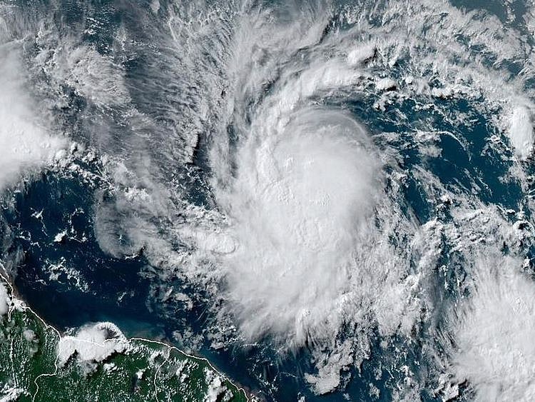
Washington: Beryl, the deadly hurricane currently dousing the Caribbean, has already broken records for how early such a powerful storm has formed in the Atlantic Ocean.
Here's what to know about the hurricane, which - powered by hotter than average ocean temperatures - scientists are describing as unprecedented but perhaps not unexpected in the era of climate change.
Unusual placement
Beryl formed on Friday southeast of the Antilles, rapidly becoming a Category 1 storm by Saturday.
It's "the furthest east a hurricane has ever formed this early in the year," Brian McNoldy, a hurricane researcher at the University of Miami, wrote in a blog post.
Waters in that part of the Atlantic are typically too cold to support hurricanes this time of year, Andra Garner, a climate scientist at Rowan University, told AFP.
Rapid intensification
Less than 24 hours later, by Sunday, Beryl became a major Category 4 storm.
"It's hard to communicate how unbelievable this is," McNoldy wrote.
"It's startling to see this happen before your eyes, but it's also kind of in line with what the science tells us we might expect in a warmer world," added Garner.
"While it is unprecedented, I can't say that it's unexpected."
Earlier than ever
Beryl also broke a record when it became a Category 4 storm: A hurricane of that level had never been recorded in the Atlantic in June.
By the first day of July, a day later, it broke records again, as the earliest ever Category 5 hurricane.
The North Atlantic hurricane season runs from the beginning of June to the end of November.
According to the US National Oceanic and Atmospheric Administration, major storms - Category 3 and above - usually form around the end of August or beginning of September.
Unusually warm Atlantic waters
The driving principle behind these factors is the temperature of the Atlantic Ocean, which has been at record levels for more than a year.
Warm waters "can allow the storm to get going and to strengthen," said Garner.
"And when those waters are extra warm, warmer than we expect, it's kind of like having an extra shot of caffeine in your coffee."
North Atlantic waters are currently between 2 and 5 degrees Fahrenheit (1 and 3 degrees Celsius) warmer than normal, according to NOAA.
Temperatures in May were close to those typically expected in August.
Beryl is "almost exactly what we do expect, from a climate science perspective," said Garner.
Sign up for the Daily Briefing
Get the latest news and updates straight to your inbox
Network Links
GN StoreDownload our app
© Al Nisr Publishing LLC 2026. All rights reserved.