Tropical depression Wilma: Up to 200mm of rainfall expected, Signal No.1 raised in eastern Philippines
Tropical Depression Wilma picks up speed, threatens eastern Philippines
Manila: Tropical Depression Wilma has accelerated early on Friday (December 5) while moving westward over the Philippine Sea, according to storm trackers.
"Heavy to intense rains" are expected as Wilma, the 23rd cyclone of the year, combined with shear line, is now positioned off Eastern Visayas and north-east of Catanduanes, expected to make landfall starting today.
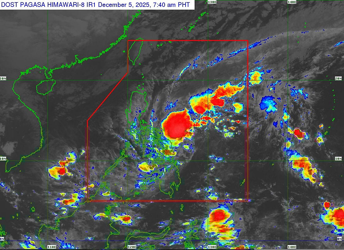
Wilma's track forecast off satellite image?
A close looks indicates discrepancy between storm track forecast of Pagasa, which shows Wilma's trajectory slightly lower than what the Himawari-8 satellite snapshot timestamped at 7.40am on December 5, 2025 shows.
Signal No. 1 raised
The weather bureau Pagasa has raised Tropical Cyclone Wind Signal No. 1 over seven areas in Visayas, including:
Northern Samar
Eastern Samar
Samar
Biliran
Leyte, and
Southern Leyte
Weather bureau Pagasa said this area of coverage could potentially "expand".
Key warnings
Wind wignals: Signal No. 1 indicates winds of 30-60 kph within 36 hours, affecting Visayas and possibly Mindanao areas like Dinagat Islands.
Rainfall forecast: Heavy to intense rains of 100-200 mm expected in Northern and Eastern Samar due to Wilma, with 50-100 mm elsewhere; combined with shear line, up to 200 mm in Bicol Region (Catanduanes, Albay, Sorsogon).
Track and Intensity: Wilma moves west-southwest at 20 kph with 45 kph winds (gusts to 55 kph), likely crossing Visayas until Monday, then over the Sulu Sea and north of Palawan.
Currently, Wilma's path has high uncertainty, said local weather trackers.
Public advisory
Residents in Bicol, Eastern Visayas, and Mindanao should prepare for flooding, landslides, and strong winds starting Friday; monitor Pagasa updates and follow evacuation orders.
Pagasa vigilance as Wilma intensifies, emphasising risks to life and property.
Sign up for the Daily Briefing
Get the latest news and updates straight to your inbox
Network Links
GN StoreDownload our app
© Al Nisr Publishing LLC 2026. All rights reserved.