Why the monsoon arrived early in India this year: Key factors explained
Here’s a breakdown of what causes the monsoon to set in early — and why it matters
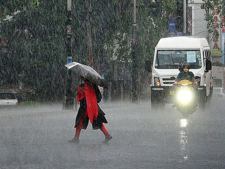
Dubai: The early onset of the southwest monsoon over Kerala this year, several days ahead of its usual schedule, has caught the attention of meteorologists, farmers and policymakers alike.
With above-normal pre-monsoon showers and heavy rainfall already triggering red alerts in Kerala and Tamil Nadu, experts say a confluence of atmospheric and oceanic conditions helped fast-track the arrival of India’s most important weather system.
Here’s a breakdown of what causes the monsoon to set in early — and why it matters.
What is the normal monsoon timeline?
An early onset means the monsoon winds, which blow from the Indian Ocean toward the subcontinent, reach Kerala and adjoining areas before the expected date.
This year, the India Meteorological Department (IMD) declared the monsoon’s arrival as early as May 25.
What causes the monsoon to arrive early?
Meteorologists point to a combination of several key factors that can trigger an early onset:
Stronger-than-usual cross-equatorial winds
During may, winds from the southern hemisphere begin to blow across the equator and enter the Arabian Sea. When these winds are stronger and more organised, they push moisture-laden air toward the Indian coast more quickly, hastening the monsoon’s arrival.
Above-normal sea surface temperatures
Warmer-than-usual waters in the Arabian Sea and Bay of Bengal fuel intense convection (rising air currents), which helps develop cloud bands and low-pressure systems needed for monsoon formation.
In 2025, sea surface temperatures in the region were higher than average, aiding early cloud development.
Early formation of low-pressure areas or depressions
The formation of a low-pressure area over the Bay of Bengal or Arabian Sea can accelerate monsoon winds toward the Indian subcontinent.
These systems act like a magnet, drawing moisture-laden air northward.
Madden-Julian Oscillation (MJO)
This is an eastward-moving pulse of cloud and rainfall near the equator.
If the MJO phase is favorable and located near the Indian Ocean, it can boost convection and rainfall activity, aiding early monsoon onset.
Weak or neutral El Niño conditions
Fading El Niño / transition to La Niña
The transition from an El Niño year to a La Niña phase often leads to stronger monsoon winds. In early 2025, global climate models indicated El Niño weakening and possible La Niña development — a pattern historically associated with stronger and earlier monsoon seasons in India.
Pre-monsoon disturbances
Several pre-monsoon weather systems, including a likely low-pressure area expected to form over the Bay of Bengal by May 27, enhanced early rainfall activity.
These disturbances helped saturate the atmosphere and acted as a catalyst for monsoon advancement.
What are the implications of an early monsoon?
Agriculture boost
An early onset can benefit rain-fed agriculture, especially in southern and central India, by providing farmers more time to prepare for sowing and allowing better soil moisture build-up.
Risk of flooding and landslides
However, intense rainfall in a short period — as seen in Kerala and Tamil Nadu this week — raises the risk of flash floods, waterlogging, and landslides, particularly in vulnerable hilly regions like Wayanadand the Nilgiris.
Reservoir recharge
In regions like Erode in Tamil Nadu, where reservoirs such as the lower bhavani project dam are key to irrigation, early rains help improve water storage levels, much to the relief of farmers preparing for the next crop cycle.
What's next?
Meteorologists are watching the development of the low-pressure system in the Bay of Bengal, which could influence further monsoon progress into the interiors of Tamil Nadu, Karnataka, and Andhra Pradesh. The IMD will also update its seasonal rainfall forecast based on new data from the Arabian Sea and Pacific Ocean.
While an early monsoon brings hope to agriculture and water-deficient regions, it also calls for heightened vigilance in landslide-prone and coastal areas.
With the Southwest monsoon now underway, India enters its most critical weather phase — one that touches everything from food security to power supply to disaster preparedness.

Sign up for the Daily Briefing
Get the latest news and updates straight to your inbox
Network Links
GN StoreDownload our app
© Al Nisr Publishing LLC 2026. All rights reserved.