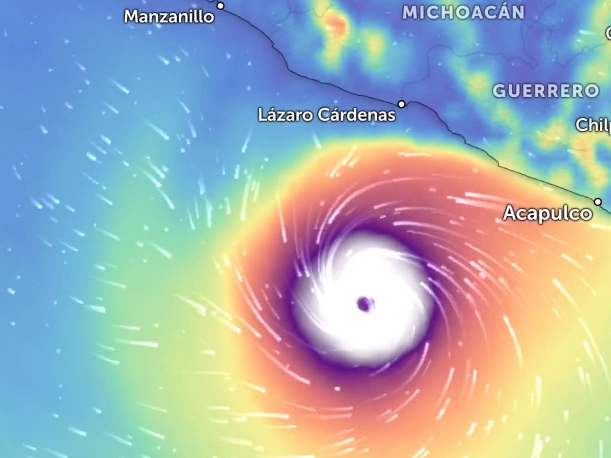
Hurricane Polo has exploded into a Category 5 storm off southwestern Mexico, becoming one of the most powerful hurricanes ever observed in the eastern Pacific as it draws energy from exceptionally warm ocean water.
The US National Hurricane Center (NHC) said Polo reached 180 mph (285 km/h) maximum sustained winds on Tuesday afternoon, with a remarkably low central pressure of 892 millibars based on measurements from a NOAA Hurricane Hunter aircraft.
Polo could bring heavy rain, rough surf and tropical-storm-force winds to parts of Mexico late Tuesday into early Wednesday, the Miami-based National Hurricane Centre said.
On Monday, Polo was moving east. But forecasters said it would make a “sharp turn” in a west-northwest or northwest direction by late Tuesday, according to an advisory. The hurricane was expected to travel along the coast of western Mexico but stay offshore.
Within roughly 24 hours since Monday, it had intensified into a Category 5 hurricane — an example of rapid intensification, in which a tropical cyclone's maximum sustained winds increase dramatically over a short period.
The storm was about 215 miles (345 km) south of Zihuatanejo and was forecast to remain offshore while tracking slowly near Mexico's southwestern coast.
By the numbers
180 mph (285 km/h): Polo's maximum sustained winds in the latest NHC advisory.
892 mb: Its estimated minimum central pressure measured by a NOAA Hurricane Hunter — an exceptionally low reading.
Category 5: The highest category on the Saffir-Simpson Hurricane Wind Scale.
24 hours: Roughly the time in which Polo went from a tropical storm to a Category 5 hurricane.
215 miles (345 km): Approximate distance south of Zihuatanejo in the latest advisory.
35 miles (55 km): Distance hurricane-force winds extend from Polo's centre.
90 miles (150 km): Extent of tropical-storm-force winds.
3–6 inches (75–150 mm): Rainfall forecast for coastal Guerrero and Michoacán, with isolated totals of up to 8 inches.
2–4 inches (50–100 mm): Possible rainfall across coastal Oaxaca, Colima and Jalisco.
31°C (88°F): Approximate sea-surface temperatures beneath Polo's track, providing a major source of energy for strengthening.
Warm ocean, weak wind shear create explosive storm
Polo's rapid intensification is being driven by an unusually favourable atmospheric and oceanic setup.
NHC analysis found sea-surface temperatures above 30.5°C (86.9°F) beneath the storm, along with light vertical wind shear and abundant moisture — conditions that allow a hurricane's circulation to become more organised rather than being disrupted by stronger winds aloft.
Warm water also extends below the ocean surface along Polo's path. That matters because powerful hurricanes normally churn up cooler subsurface water, which can weaken their fuel supply. In Polo's case, the deep reservoir of warm water reduces that cooling effect.
Is El Niño responsible?
There is an important climate connection, but it is more complicated than simply saying "El Niño created Polo."
NOAA's Climate Prediction Center says El Niño is strengthening, with sea-surface temperature anomalies exceeding 3°C in parts of the eastern equatorial Pacific in August. The latest NOAA assessment puts the probability of a very strong El Niño during the Northern Hemisphere autumn and winter above 90%.
NOAA's tropical-hazards outlook also says El Niño is currently dominating the global tropics and notes Polo's rapid intensification in the eastern Pacific.
But the immediate ingredients identified by forecasters for Polo's explosive strengthening are the exceptionally warm water, abundant moisture and favourable wind-shear conditions. It would be too simplistic to attribute the storm's intensity solely to El Niño.
Sign up for the Daily Briefing
Get the latest news and updates straight to your inbox
Network Links
GN StoreDownload our app
© Al Nisr Publishing LLC 2026. All rights reserved.