NASA astronaut Donald Roy Pettit shared a breathtaking photo of Burj Khalifa, the world’s tallest building in Dubai, from the vantage point of the International Space Station (ISS). Pettit posted the spectacular night-time image of Burj Khalifa glowing distinctly amidst the illuminated cityscape of Dubai. The striking photograph shared on Pettit’s X account has captured Downtown Dubai from the lower Earth orbit. The Burj Khalifa stands out prominently, its facade emitting a radiant silver hue, visibly caused by the building’s distinctive facade, making it one of the visible landmarks from space.
Look: Images of the UAE from space over the years
Landmarks captured by UAE’s satellite Khalifasat and NASA
Last updated:
3 MIN READ
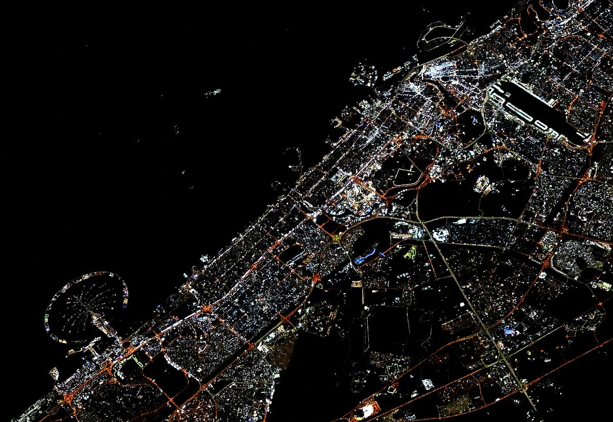
NASA astronaut Donald Roy Pettit has shared a image showing the night view of Dubai’s city lights.
X/Donald Roy Pettit
1/26
2/26
A view of Downtown Dubai, with the shadow of the Burj Khalifa, the world’s tallest building, cast over the Dubai Mall.
3/26
Ain Dubai, the world’s largest and tallest observation wheel extending to 250m in the sky on Bluewaters Island, taken on January 7, 2022.
4/26
Dubai Canal and surrounding area.
5/26
A view of Zabeel park and Dubai Frame.
6/26
Dubai Canal and surrounding area.
7/26
The Museum of the Future captured by KhalifaSat.
8/26
A stunning photo taken from space by KhalifaSat shared by the Mohammed Bin Rashid Space Centre on 1 st September 2021 shows the Expo 2020 Dubai site. The photo taken from around 613km above Earth prominently shows Al Wasl Plaza and the entire site of the global cultural event that will bring together 191 countries in the UAE for the world’s most incredible show that opened on October 1.
9/26
A picture taken by International Space Station of space cargo freigher Dragon orbiting over Dubai on July 27, 2019.
10/26
This astronaut photograph illustrates the varying character of surfaces on Sir Bani Yas, an island near the west coast of the United Arab Emirates, on March 15, 2010.
11/26
Dubai, pictured from the International Space Station as it orbited 261 miles above on Feb. 4, 2021.
12/26
The stunning picture of UAE from the ISS space station taken by Hazza Al Mansouri, the first astronaut from the United Arab Emirates to venture into space.
13/26
NASA astronaut Donald Roy Pettit shared a breathtaking photo of Burj Khalifa, the world’s tallest building in Dubai, from the vantage point of the International Space Station (ISS). Pettit posted the spectacular night-time image of Burj Khalifa glowing distinctly amidst the illuminated cityscape of Dubai. The striking photograph shared on Pettit’s X account has captured Downtown Dubai from the lower Earth orbit. The Burj Khalifa stands out prominently, its facade emitting a radiant silver hue, visibly caused by the building’s distinctive facade, making it one of the visible landmarks from space.
14/26
The World Islands, Palm Jumeirah and Palm Jebel Ali taken on May 29, 2019.
15/26
The captivating Sheikh Khalifa bin Zayed Al Nahyan Mosque in Al Ain was captured by KhalifaSat. The mosque is distinguished by its magnificent dome, which measures 86 meters in diameter and is adorned with Arabic calligraphy.
16/26
This photo, taken by KhalifaSat, shows Jebel Jais, the highest summit in the UAE (around 2,000 m above sea level), which features the world’s longest zipline with some breathtaking views.
17/26
On 24 June 2021, Thomas Pesquet, a European Space Agency astronaut currently onboard the International Space Station, tweeted two pictures of the Palm taken from orbit and hinted at his possible involvement in Expo 2020 Dubai. He is on a six-month mission named Alpha and will become the first French commander of the space station in a month-long stint.
18/26
City lights of Dubai, are featured in this image taken by the Expedition 30 crew aboard the International Space Station.
19/26
A manufacturing site near Abu Dhabi is pictured from the International Space Station as it orbited 262 miles above.
20/26
On August 4, 2020, the Mohammed Bin Rashid Space Centre announced the completion of an updated map of the Abu Dhabi and Dubai using the UAE's first high-resolution satellite image "Mosaic", captured by KhalifaSat. The system captures a matrix of individual digital images to create a single high-resolution picture of the UAE’s terrain. This imaging system by MBRSC will provide a comprehensive view of the UAE’s topography, using remote sensing systems, image processing, geographic information systems and artificial intelligence.
21/26
Abu Dhabi pictured from the International Space Station as it orbited 263 miles above Oman on April 19, 2021.
22/26
This photo, taken by KhalifaSat, shows Dubai’s Love Lake, one of the lakes at Al Qudra where the greenery and trees create a unique natural masterpiece.
23/26
Al Jubail Island in Abu Dhabi. The island is characterized by its unique wildlife, scenic natural beauty and also features a mangrove park.
24/26
An aerial image of Palm Jumeirah, taken from space by KhalifaSat in 2018. The image was taken at 1.32pm when KhalifaSat passed over Dubai. This was the first official photo taken by the KhalifaSat — that of the Palm Jumeirah in Dubai — signalling the beginning of its five-year Earth imaging journey in space.
25/26
The fascinating domes of Sharjah Mosque from space. This photo, taken by KhalifaSat, shows the Sharjah Mosque, which can accommodate more than 25,000 worshipers. The mosque is considered a unique model of Islamic architecture.
26/26
Abu Dhabi, United Arab Emirates
Sign up for the Daily Briefing
Get the latest news and updates straight to your inbox
Network Links
GN StoreAbout Gulf NewsTerms & ConditionsReach by GNSitemapContact usPrivacy PolicyGN FocusHave your sayWork with usAdvertise with usGulf News epaperPrinting Services
Download our app
© Al Nisr Publishing LLC 2026. All rights reserved.