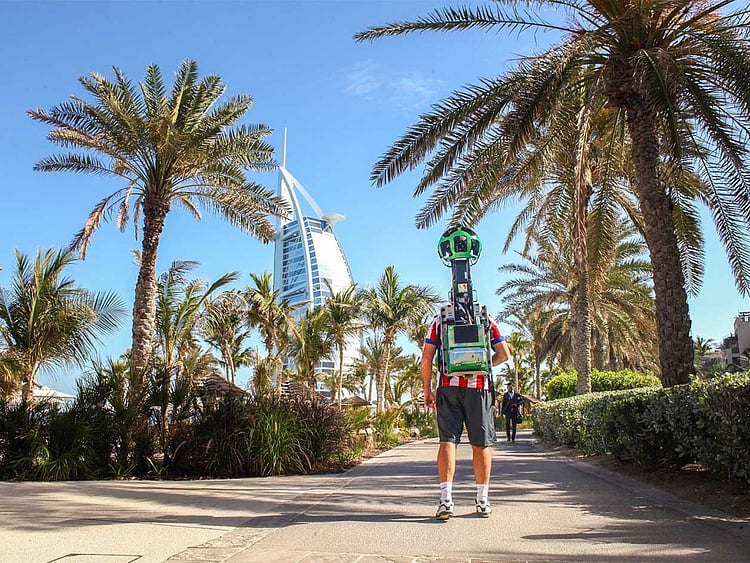
Dubai: Google launched on Monday a series of Dubai’s iconic sites on Street View, a feature by Google Maps that allows users to view and navigate 360-degree imagery of major locations across the world.
As the United Arab Emirates gears to celebrate its 45th National Day on December 2, Google Maps’ one billion daily users can now explore some of Dubai’s world-renowned landmarks such as the city’s picturesque creek and the dhows which line its docks in crisp 360-imagery.
The imagery was launched within Street View Special Collects, a feature of Google Maps that lets users explore places around the world like landmarks, natural wonders, as well as culturally and historically significant sites.
The sites launched showcase Dubai’s versatile urban landscape, from the waterfront Souk at Madinat Jumeirah, to the Dubai Aquarium and Underwater Zoo.
Ulf Spitzer, Global Lead for the Google Street View Programme, stated: “Google Maps’ one billion users around the world will now be able to get to know Dubai a little better with this versatile set of landmarks now available online for the world to explore. We are excited about this wave of Special Collects, especially now as people all over the country prepare to mark the UAE’s 45th National Day.”
Street View, a feature by Google Maps that will allow users to view and navigate 360 degree street-level imagery of major streets across the city, has been available in Dubai since 2014. Burj Khalifa marked the first Special Collect in the UAE and was launched in 2013.
This is the latest in a series of Street View imagery collected of major landmarks in the Middle East and North Africa (Mena), after Petra in Jordan, Burj Khalifa in Dubai, the Shaikh Zayed Grand Mosque, Doha’s Museum of Islamic Art, and the Pyramids of Giza in Egypt.
Here are some of the sites launched on Sunday:
To see all sites please visit this link.
Sign up for the Daily Briefing
Get the latest news and updates straight to your inbox
Network Links
GN StoreDownload our app
© Al Nisr Publishing LLC 2026. All rights reserved.