Video: Nasa brings a special gift to Dubai at MBRSC space event
SCaN team behind communication from ISS including that of astronaut Al Neyadi at SpaceOps
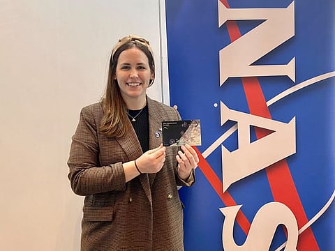
Dubai: When officials of the National Aeronautics and Space Administration, the US Space Agency Nasa, come down to Dubai for a global space conference, what better gift than a unique postcard showing Dubai’s astronomical growth from space can be given to the delegates? That is exactly what NASA’s Space Communications and Navigation programme (SCaN) team did.
Participating at the weeklong 17th International Conference on Space Operations (SpaceOps 2023) at the Dubai International Convention and Exhibition Centre, the SCaN team gave away to delegates and visitors a unique lenticular postcard showing the magnificent transformation of the emirate’s coastline as seen from space.
Striking difference in landscape
The striking difference in the landscape over the past four decades is shown through the satellite images captured in 1986, 2002 and 2021.
The images have been captured by the satellites used for the Landsat Earth Observation Mission, a joint venture of the US Geological Survey (USGS) and Nasa.
The first two images were captured by Landsat 5 and the last one by Landsat 8, Kate Manning, communications specialist, Nasa SCaN, told Gulf News.
“These images come through our networks at Nasa, specifically our Near Space Network, which is part of our Space Communications and Navigation programme … The Landsat Mission is operated at NASA’s Goddard Space Flight Center in Maryland, just outside Washington DC. Their team, specifically the team at the USGS, put these together as a public outreach tool.”
Manning said a friend’s friend who is involved in the project gave her the idea of using the postcard for outreach here in Dubai during the visit of the SCaN team.
Al Feinberg, media specialist, SCaN, added: “This shows the unique growth of Dubai in a great context and we enjoyed sharing this with everyone here.”
How Landsat captures Dubai
The text printed on the postcard goes like this. “There are few coastlines on Earth quite like the one along Dubai. Two decades ago, there was not much of note along the city’s coast, aside from the shallow waters of the Arabian Gulf. Today, that coastline is the site of some of the largest and most recognisable land reclamation projects in the world. To construct this unusual landform called Palm Jumeirah, workers dredged sand and silt from the sea floor, sprayed it into the desired shape with GPS technology and ships, and mixed in stone [to] solidify the new islands.”
“In these false-colour images, bare ground appears brown, vegetation appears red, water appears dark blue, and buildings and paved surfaces appear light blue or grey.”
“Landsat is used to track changes in Dubai’s coast over time, including factors such as water quality, water temperature, and the presence of sediments, especially around Palm Jumeirah. Landsat satellites provide an unparalleled record of observations to help us understand how Earth is changing and what those changes may mean for life on our
planet. The consistency of Landsat’s data from sensor to sensor, and from year to year, makes it possible to track Earth’s changing surface from 1972 to the present.”
How SCaN helps UAE
Philip Baldwin, Network Operations manager, Nasa SCaN, told Gulf News: “We at SCaN provide those products, and we see these images and make sure that it actually goes to the rest of humanity and the rest of the world to see it and benefit from it.”
He said aerial overview of changes in land use can be used for various research purposes and to ensure the development is sustainable.
SCaN is also helping the UAE by providing the communication networks for the SpaceX Crew-6 mission which includes the second Emirati astronaut Sultan Al Neyadi who is on the longest Arab space mission aboard the International Space Station (ISS).
“SCaN provides space communication and navigation with the ISS all the time. We constantly connect astronauts to Earth right from the launch pad to the space station and aboard the station. There’s very few vehicles and space communications that are able to do that communication and constant connection as it (a spacecraft) launches, all the way to the ISS. We cover all of that.”
Highlighting the importance of SCaN’s services, he said seamless connection with NASA’s Mission Control Centre in Houston provides mental comfort to astronauts on board ISS.
SCaN serves as the programme office for all of NASA’s space communications activities, enabling the success of more than 100 Nasa and non-Nasa missions. It manages the Near Space Network and the Deep Space Network. SCaN also ensures the availability and allocation of the radio frequency spectrum for all Nasa programmes.
All the live video calls and ham radio calls that astronaut Al Neyadi can make from ISS, like the one he had with His Highness Sheikh Mohammed Bin Rashid Al Maktoum, Vice-President and Prime Minister of the UAE and Ruler of Dubai on Tuesday, are facilitated by SCaN. As many as 13 live calls, 10 ham radio calls have been announced for Al Neyadi’s community outreach programme during his six-month stay on ISS.
“We also help the astronauts call their families and have some downtown watching TV or movies,” added Baldwin.
Collaborative space work
SCaN’s unique gift for Dubai received a warm welcome at SpaceOps. Saud Karmustaji, director of communications at the Mohammed Bin Rashid Space Centre, which organised SpaceOps for the first time in the Arab region, said: “We are very proud and honoured to have NASA’s team participating with us in such a big event, the largest space operations event in the world along with all the delegates from across the world.
“It is so nice that Nasa has added a nice piece of work for outreach which is very beautiful. It shows Dubai’s transition from the 80s and how it looks today using different images from their satellites and different payloads, all in one card. It shows how collaborative space is, exactly how we are all one team, working together, all inspired, all excited to explore the unknown deep space.”


