UAE evening traffic alert: Dubai-Sharjah delays on Sheikh Zayed Road and E311 at rush hour
Slow traffic near Al Khan, Al Mamzar and Deira; motorists urged to plan routes
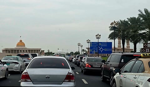
Dubai: Motorists are heading into a busy evening rush, and according to Google Maps, congestion is building across northern Dubai and along the approaches to the Sharjah border as the working day ends. Real-time conditions can be tracked on Google Maps and Waze, both of which update congestion and incident reports minute by minute.
Get updated faster and for FREE: Download the Gulf News app now - simply click here.
According to Google Maps, the heaviest pressure this evening is in the north of the city. The stretch around Al Khan, Sahara Centre and Al Mamzar, close to the Dubai-Sharjah crossing, is showing slow-moving traffic along with several reported incidents, a familiar bottleneck as commuters funnel toward Sharjah. Deira and the Port Rashid area are also congested, with road closures flagged on the map near the corniche and inner-city roads.
Closer to the centre, Google Maps shows slow patches on Sheikh Zayed Road (E11) through the Business Bay stretch, with a closure marked nearby, and knock-on pressure on Al Khail Road (E44) around the Dubai Design District. Further southwest, the map flags closures and heavier traffic around Al Quoz and near Mall of the Emirates, so drivers on that section of Sheikh Zayed Road should expect delays. There is also an incident marked near Dubai Festival City and Ras Al Khor.
By contrast, Google Maps shows the wider highway network running largely clear. Sheikh Mohammed bin Zayed Road (E311) toward Warsan, Emirates Road (E611) and Al Khail Road heading east toward Al Aweer are mostly green, making them the better options for drivers able to route around the northern and central hotspots.
Dubai Police and the RTA routinely issue advisories during the evening peak. Motorists are advised to allow extra travel time, keep a safe following distance, and check Google Maps or Waze for the fastest route before setting off.


