Magnitude 6.2 earthquake strikes 58 km west of Tobelo in Halmahera, Indonesia
Deep 6.2 quake rattles North Maluku, no immediate damage reported
Last updated:
1 MIN READ
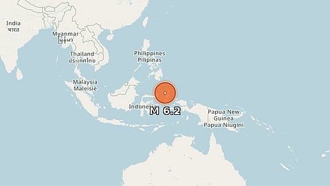
A magnitude 6.2 earthquake occurred at a depth of approximately 121 km, with epicentre 58 km west of Tobelo in North Maluku, Indonesia.
Preliminary reports varied slightly in magnitude from 6.0 to 6.3 and depth from 109 to 127 km, sourced from agencies like USGS and GFZ.
The event prompted widespread posts noting moderate surface shaking expected but no immediate reports of damage or casualties.


Get Updates on Topics You Choose
Up Next


