Hurricane Joaquin barrels over Bahamas en route to US
Jittery residents in US battened down ahead of its anticipated arrival

MIAMI: Hurricane Joaquin battered parts of the Bahamas as an “extremely dangerous” Category Four storm, while jittery residents in the eastern United States battened down ahead of its anticipated arrival.
The storm, which was packing sustained winds of 215 kilometers per hour, slowed to a crawl and was “meandering over the central Bahamas,” the National Hurricane Center said.
“On the forecast track, the core of strongest winds of Joaquin will move near or over portions of the central Bahamas (late Thursday) and pass near or over portions of the northwestern Bahamas on Friday,” the NHC said in its 0300 GMT bulletin.
The NHC described Joaquin as a large storm moving west at only six kilometers per hour.
“Hurricane-force winds extend outward up to 80 km from the centre and tropical storm-force winds extend outward up to 185 miles,” the bulletin said.
The storm has potential to inflict death and destruction, according to the hurricane center, which classified Joaquin as an “extremely dangerous” Category Four storm,
Its current path was likely to cause coastal flooding in the mid-Atlantic US region, forecasters said.
Cuban officials issued a tropical storm warning for much of the south-eastern part of the island, meaning that hurricane conditions are expected somewhere within the warning area.
Emergency preparations began as far north as New York, and officials in the Bahamas urged people to brace for up to 37 centimeters of rain.
US President Barack Obama was briefed on the preparations, the White House said.
Classes were called off in the Bahamas, some flights were cancelled and cruise ships headed for the popular vacation destination were diverted elsewhere.
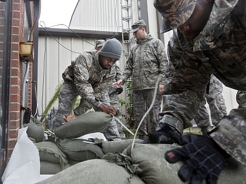
Residents of the eastern US cleared grocery shelves of water, milk and other essentials before the storm’s arrival.
‘Catastrophic situation’
Since Joaquin is moving slowly “a catastrophic situation may unfold” in the Bahamas “with a prolonged period of intense hurricane conditions,” according to www.weather.com.
Torrential rains are likely in the Carolinas and Virginia, US media reported.
A dangerous and life-threatening storm surge will raise water levels by as much as 10 feet above normal tide levels in parts of the central Bahamas, the reports said.
The Bahamas are an island chain that at its most northern point sits off the coast of southern Florida.
In Virginia, which was already hit by flash flooding Tuesday, the governor declared a state of emergency to prepare for more rain even before Joaquin arrives. Authorities in New Jersey did the same.
“The forecast of up to 10 inches of rain in areas across Virginia could result in floods, power outages and a serious threat to life and property,” Governor Terry McAuliffe said.
In Virginia, the Norfolk Naval Station, the biggest US naval base, was warned that the storm could bring destructive winds.
Local NBC affiliate WAVY reported that ships were told to be prepared to get underway within 48 hours if necessary.
Joaquin is the third hurricane of the 2015 Atlantic season, which began in June and ends in November. Peak activity usually occurs in September.
The most destructive weather pattern so far this year was Tropical Storm Erika, which killed around 30 people and caused extensive damage in August on the small Caribbean island of Dominica.
The National Oceanographic and Atmospheric Administration had predicted a less active hurricane season than usual because of the El Nino phenomenon, which inhibits storm formation.
Forecasters earlier this year also noted the dampening effects of below-average sea-surface temperatures in the tropical Atlantic. Hurricane formation is associated with warmer waters.


