Philippine tropical cyclone: 'Crising' brings intense rainfall
Residents in areas with heavy rainfall urged to prepare for severe flooding, landslides
Manila: Weathermen urged residents to prepare for significant rainfall and possible severe weather conditions as Tropical Cyclone Crising continues its advance, further intensified by the Southwest Monsoon.
The Philippine Atmospheric, Geophysical and Astronomical Services Administration (Pagasa) also warned residents in affected regions to remain alert for possible flooding and landslides over the next 72 hours, especially in urban or low-lying areas.
Precautionary measures
Residents in areas forecasted with >200 mm rainfall should prepare for severe flooding and landslides.
Stay updated with official bulletins.
Evacuate if local authorities issue warnings.
Avoid travelling through flooded roads or landslide-prone areas.
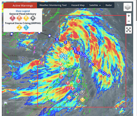
As of 2pm, Tropical cyclone Crising was seen moving closer ro the mainland Cagayan-Babuyan islands area.
Wind Signal No. 2 are still up in 10 provinces in the north, with signal No. 1 in place over the rest of Northern Luzon and the northern parts of Aurora and Nueva Ecija.
Forecast: Rainfall and regional impacts
Tropical Cyclone Crising
July 18 to Noon, July 19
Cagayan, Apayao, Ilocos Norte, Ilocos Sur: Over 200 mm of rain.
→ Widespread severe flooding and landslides expected.Batanes, Isabela, Abra, Benguet, Kalinga, Mountain Province, Ifugao, La Union, Pangasinan: 100–200 mm.
→ Numerous flooding incidents, especially in urban, low-lying, or riverside areas. Landslides likely in susceptible sites.Nueva Vizcaya, Quirino, Aurora: 50–100 mm.
→ Localised flooding and potential landslides in vulnerable locations.
Noon, July 19 to Noon, July 20
Ilocos Norte, Ilocos Sur, Abra: 50–100 mm.
→ Localised flooding and landslide risk persists.
Noon, July 20 to Noon, July 21
No significant new rainfall totals expected from the cyclone for main areas above.
Southwest Monsoon ("Habagat"): Forecast
July 18 (Today) to Noon, July 19
Zambales, Bataan, Palawan, Occidental Mindoro, Antique, Iloilo, Guimaras, Negros Occidental: 100–200 mm.
→ Numerous flooding events and likely landslides in moderately to highly susceptible zones.Metro Manila, Tarlac, Pampanga, Nueva Ecija, Bulacan, Cavite, Laguna, Batangas, Rizal, Quezon, Bicol Region, parts of Visayas and Mindoro: 50–100 mm.
→ Localised flooding and potential landslides, especially in urban or low-lying areas.
Noon, July 19 to Noon, July 20
Pangasinan, Zambales, Bataan, Occidental Mindoro, Antique: 100–200 mm.
Flooding and landslides remain likely for the same vulnerable areas.
Noon, July 20 to Noon, July 21
Zambales, Bataan: 100–200 mm.
Flood risk continues, landslides possible in high-risk locations.Pangasinan, Tarlac, Pampanga, Occidental Mindoro, Romblon: 50–100 mm.


