SpaceX will launch a methane satellite to hold super polluters accountable
Carbon Mapper will focus on tracking methane 'super emitters,' including oil and gas wells
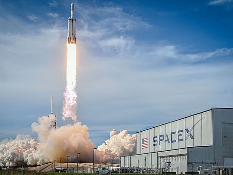
There's about to be a new methane eye in the sky. SpaceX is scheduled to launch on Friday the Tanager-1 satellite.
The nonprofit Carbon Mapper is behind the satellite and will make the data available once it's operational in the coming months. Tanager-1 is the second methane-detecting satellite launched in the past six months by a nonprofit, reflecting the growing scrutiny around the potent greenhouse gas and the satellites' low cost relative to others used for atmospheric monitoring.
Developed by Planet Labs PBC with technology from NASA's Jet Propulsion Laboratory, Tanager-1 will be able to help pinpoint methane and carbon dioxide emissions from individual facilities. The satellite — no bigger than a mini-fridge — will attribute emissions within 50 meters of the source.
Carbon Mapper will focus on tracking methane "super emitters," which include oil and gas wells, large livestock operations, landfills, and industrial refineries. This is the first step in the plan from the Carbon Mapper Coalition — a philanthropically funded public-private partnership — to deploy a constellation of satellites to observe up to 90 per cent of major sources of emissions globally. (The coalition has received funding from Bloomberg Philanthropies, the philanthropic organization of Michael Bloomberg, the founder and majority owner of Bloomberg LP, which owns Bloomberg News.)
The energy industry's methane emissions are at near-record levels despite reduction pledges. Between 20 per cent and 60 per cent of methane emissions from US oil and gas basins come from just 1 per cent of super-emitting sources. The gas is roughly 80 times more potent than CO2 over 20 years, and better oversight of super emitters could pay major climate dividends.
The public emissions data could become a market mechanism according to Carbon Mapper Chief Executive Officer Riley Duren. "If you have empirical evidence of [methane leaks from] liquid natural gas, then you can differentiate between cleaner consumers and producers of natural gas," he says.
Businesses operating in countries aiming to clean up high-emitting sectors could rely on satellite data to shift supply chains. In May, the European Union approved a law that will penalize liquid natural gas imports above a certain methane-intensity threshold starting in 2030. Additional regulations for monitoring and reporting methane intensity will come into effect in 2027 and 2028.
Duren adds that public data from Tanager-1 could assist with recent US government efforts to increase accountability for methane super emitters. In June, the US Department of Energy and Environmental Protection Agency announced $850 million in funding to reduce methane pollution from oil and gas, and in July the EPA signaled intent to review its methane standards for landfills. Leveraging satellite data, government regulators, environmental NGOs, journalists and super emitters themselves will be able see where unexpected methane plumes emerge. Moreover, people who live near oil and gas fields will have greater information about when methane leaks threaten them.
Carbon Mapper currently conducts aerial emissions surveys, which it has used to notify regulators about methane leaks. "In nearly 50 per cent of the cases, more than half of what we were seeing was unknown to them," Duren says. "We want to scale up that action globally."
While aerial surveys allow for extremely precise measurements, satellites offer a global view that can track emissions in foreign jurisdictions where it's challenging to dispatch planes and drones.
Carbon Mapper's plan to scale capitalizes on a key advantage of emissions-tracking satellites: they're cost effective.
Satellites that can measure atmospheric concentrations of various gasses used to cost over $500 million a piece, Duren explains, sometimes surpassing $1 billion. Developed and launched by NASA, those like the Orbiting Carbon Observatory were designed to answer specific scientific research questions.
"But if you're launching a satellite to measure just methane and CO2, it's much cheaper than a satellite that measures all kinds of gasses," says Harvard Professor Daniel Jacob, who specializes in atmospheric chemistry.
The Environmental Defense Fund launched a methane-tracking satellite with support from Google in March that cost $88 million. Tanager-1, along with a second satellite Carbon Mapper has in the works, cost a combined $130 million.
Methane-tracking satellites have proven to be valuable tools, though many government agencies are hesitant to use them to track emissions and set regulations. "It still feels a bit exotic," Jacob explains. "It's why the EPA prefers people having people walking around with handheld devices "- which is an awful way to measure emissions. But they understand it more."
Large oil and gas companies — including Petroleos Mexicanos and Kazakhstan firm Buzachi Neft — also dispute satellite data showing their pollution. In 2022, Pemex CEO Octavio Romero Oropeza posted a video of himself in a helicopter above an oil rig to claim satellites were falsely showing a methane leak.
But Jacob explains that "large point sources tend to be highly intermittent." The monitoring that satellites offer is the key to showing when super emitters have brief but environmentally damaging methane leaks.
Tanager-1 will not be able to provide a constant watch, however. It will travel in low-Earth orbit a few hundred miles above the surface. It's path means it will take weeks or even months to return to the same location above the planet. During this time, methane leaks could emerge, be fixed, and go undetected.
Jacob says one of the best solutions to this problem is using satellites in geostationary observation. Those satellites stay perched over the same location roughly 36,000 kilometers above Earth. In March, scientists hacked a geostationary weather satellite to monitor methane with continuous, real-time coverage.
Carbon Mapper's plan to scale its satellite program could provide another solution. Duren says the nonprofit aims to ultimately have more than 10 satellites, which could potentially lower the return time to less than a day.


