Sheikh Mohammed announces second Emirati-made satellite
MBZ-SAT will be built at Mohammed Bin Rashid Space Centre in Dubai by 2023


Dubai: The UAE moves ahead with the global race to space. His Highness Sheikh Mohammed bin Rashid Al Maktoum, Vice President and Prime Minister of the UAE and Ruler of Dubai, announced on Wednesday a new earth observation satellite that will be launched in 2023.
The satellite called MBZ-SAT, named after His Highness Sheikh Mohamed bin Zayed Al Nahyan, Crown Prince of Abu Dhabi and Deputy Supreme Commander of the UAE Armed Forces, is the second satellite that will be built by a team of Emirati engineers at the Mohammed Bin Rashid Space Centre (MBRSC) in Dubai. It will also become the UAE’s fourth Earth observation satellite to be launched by MBRSC, after KhalifaSat – the first Emirati made satellite that was launched in 2018; and DubaiSat-1 and DubaiSat-2 that were launched in 2009 and 2013 respectively.
“We approved building the new satellite MBZ-Sat, the region’s most technologically advanced in the civil and commercial sector, to be 100 per cent designed by Emiratis,” Sheikh Mohammed posted on his official Twitter account.
“Our efforts continue towards developing a competitive and integrated space sector, led by national experts, astronauts and research centres. Our Hope Probe and lunar rover (Rashid) are the beginning of the UAE’s participation in the global race to space,” he added.
Improving the quality of life
Sheikh Mohammed highlighted: “The space sector is a key strategic sector that we strongly support, due to its role in improving the quality of life for people and providing humanity with innovative solutions for a better future. With the help of our national talent, we can raise the level of our ambitions and continue to support international efforts in the field of space science to serve the interests of both the region and the world.”
“We have chosen the name MBZ-SAT for the new satellite, which will be designed and developed by Emirati competencies and bear the initials of my brother Mohammed bin Zayed Al Nahyan, Crown Prince of Abu Dhabi and Deputy Supreme Commander of the UAE Armed Forces,” he added.
“The name was chosen in honour of the achievements he has contributed to, of which we are proud of among nations. Our goal is to fully benefit from space science and find new opportunities to support the development of our country and the region, and also help societies overcome environmental and developmental challenges so they can prosper and progress,” Sheikh Mohammed underlined.
New era of space science
Sheikh Mohammed also gave the name KhalifaSat to the previous satellite, in honour of His Highness Sheikh Khalifa bin Zayed Al Nahyan, President of the UAE. Launched on October 30, 2018 from Japan’s Tanegashima Space Center, KhalifaSat became the first satellite to be developed in the Arab world and ushered in a new era of space science and advanced technology for the region, according to MBRSC.
KhalifaSat currently provides high-resolution imagery of the Earth which are used for urban planning, climate change monitoring, area classification, monitoring or environmental changes and aiding relief efforts for natural disasters.
Better, faster, higher resolution imagery
During a virtual press briefing from MBRSC on Wednesday, Amer AlSayegh, Senior Director, Space Engineering Department at MBRSC, said MBZ-SAT will provide better, faster and higher resolution imagery to local and international entities.
“New Earth images will be available within two hours and can be downloaded to any ground network outside the UAE,” explained AlSayegh, adding: “The download speed of MBZ-SAT will be 1.2 GHz, which will be four times faster than the previous missions/ satellites.”
“MBZ-SAT will be equipped with an automated system for arranging images round-the-clock, ensuring that it provides the highest quality standards of satellite images intended for commercial use globally. This project will strengthen the UAE’s partnerships in the space industry between the public and private sectors,” according to MBRSC.
MBRSC added: “MBZ-SAT will contribute to meeting the growing commercial demand for high-resolution satellite images that will show details within an area of less than one square meter, which will be one of the most advanced features ever.”
Boosting UAE’s space sector
AlSayegh said MBRSC will collaborate with local companies to manufacture and supply the components necessary for the development of MBZ-SAT.
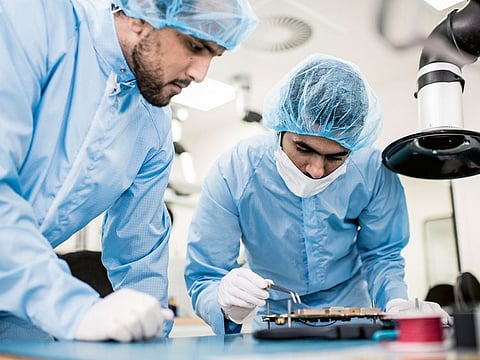
When asked by Gulf News if there will be international partners, AlSayegh noted some parts of the satellite will be sourced from international entities but the strategic objective is to support the UAE’s space sector by developing the MBZ-SAT entirely in the UAE. He also told Gulf News that around 200 engineers and staff from MBRSC will work on the project
Lighter and more compact MBZ-SAT
AlSayegh said MBZ-SAT is lighter and more compact than other UAE satellites. Its dimension will be 3m x 5m and will weigh around 700 kg, which is half lighter than an average Earth observation satellite. Its life span, once in orbit, will be around five years.
AlSayegh did not mention about the cost of the project but he explained a one-kilo reduction in the mass of the satellite will translate to a savings between US$80,000 to US$100,000 in satellite launch cost.
He told Gulf News MBZ-SAT will be a low observation satellite that will orbit the Earth from a distance between 500 – 600 kms away. Its image capture resolution will be more than double what than the previously launched system.
According to MBRSC, “MBZ-SAT will be the first satellite capable of detecting a larger number of man-made as well as natural elements with a higher rate of precision and resolution, as compared to the current range of Earth observation satellites. Furthermore, the raw data gathered by the new satellite’s system will be able to process better AI functionality that can assist in quicker analysis and processing of satellite imagery.”
MBRSC has been providing detailed, high resolution satellite images that have been captured through satellites DubaiSat-1, DubaiSat-2 and KhalifaSat for more than a decade. It is also part of the International Disaster Charter and Sentinel Asia, playing a crucial role in disaster relief and management globally.


