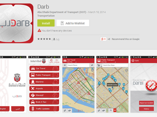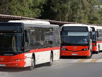
Abu Dhabi: A new app rolled out in the capital on Wednesday will make smartphones even smarter by helping motorists avoid congested roads and traffic delays through real-time information from traffic officials.
Named Darb (path or road) and launched by the Department of Transport (DoT), the app provides motorists real-time data via coloured maps depicting traffic jams and back-ups due to collisions.
Motorists can then choose alternative routes around congested areas shown on digital city maps to make driving through the city easier and hassle-free, said authorities yesterday.
The app also offers information for public transport users and travellers on bus schedules, ferry timings, facilities to book taxis and airport schedules within the emirate of Abu Dhabi.
“According to international standards, we expect that the application will reduce congestion and smooth traffic flow by about 15 to 25 per cent,” said Salah Al Marzouqi, director of integrated intelligent transportation systems at the department.
“The app will help divert traffic away from incident areas. To ensure that it can handle thousands of users at the same time, we have also tested the application via a simulator and will continue to monitor its use and enhance its capabilities,” Al Marzouqi told Gulf News.
The application is part of the DoT’s Dh9 million Integrated Transport Information and Navigation System (i-TINS), and has been developed over the last few months. It is currently available in English and Arabic for phones using both iOS and Android operating systems. In addition, the services can be accessed through a dedicated website on personal computers.
To ensure that updated information is available at all times, traffic specialists collect and verify data from various authorities, including police, weather bureaus and airport authorities, and make updates available for road users. The verifications will be carried out within three to five minutes of an incident taking place, said Hamad Al Afifi, section head of traffic management and technology operations.
In its first phase, the services are available for users in the capital, and will soon be extended to Al Ain and Al Gharbia (Western Region).
Officials said they expect a high rate of user penetration for the app, especially as a large proportion of the population is known to use smartphones. In fact, a Google survey conducted in early 2013 found that more than 73 per cent of respondents used smartphones, the highest rate of smartphone penetration in the world. This rate of penetration was ahead of South Korea and Saudi Arabia, and placed the UAE 12th, ahead of the United States.
Al Marzouqi explained that to prevent users from getting distracted, the DoT had built in automatic notifications in the app.
“This way, drivers will be able to concentrate on the road,” he said.
The official added that the data collected on road incidents is also made available to traffic engineers and road specialists, who can use it to plan for future road networks and projects.
Asked about the newly introduced names for many Abu Dhabi roads, DoT officials said that the application would feature the updated names. Although older names for streets are displayed, these will be gradually phased out.


