New service in Dubai to navigate car users in real time
Dalili Navigation system to provide motorists real-time information to help them avoid traffic jams
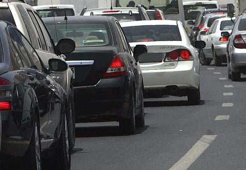
Dubai: Motorists in Dubai can have real-time information about traffic congestion and take the fastest route to their destination by using the Dalili Navigation System introduced by the Dubai Roads and Transport Authority (RTA).
The RTA on Sunday announced that it would launch the Dalili Navigation system on October 15 at a cost of Dh1,599 and Dh1,699 (with Bluetooth).
Radio 2: Feyaza Khan reports on the new navigation system to be launched in Dubai
Audio supplied by 99.3 106 Radio 2
"Dalili is a dynamic information system that unlike other navigation systems in the market, provides real-time traffic information for all the roads in Dubai and is the first-of-its-kind in the Middle East," said Maitha Obaid Bin Udai, CEO, RTA's Traffic and Roads Agency.
She told a press conference at the RTA's headquarters on Sunday that the system would help users avoid traffic congestion based on real time road information, define their locations and identify the shortest road routes.
Helping users
Maitha said the Dalili navigation system would be offered in the Mio GPS devices being marketed through International Marketing Services (IMS). "We are in touch with some other navigator developers to provide our Dalili traffic system," she said.
Traffic information regarding congestion, accidents and road diversions would be broadcast to the MIO Daili Navigators, which will analyse the data and display this on the navigator helping motorists to find the best route to their destination by avoiding congested roads on their way.
The system, which will support both Arabic and English languages, is capable of helping motorists reroute vehicles to other roads to avoid congestion and reach their destinations in the shortest possible time.
Update: What is Dalili?
Dalili is a new dynamic navigation system being used by the Dubai Roads and Transport Authority (RTA) based on the GPS technology which provides real time traffic updates and alternative routes.
Main Features:
- Real Time traffic update
- Realistic 3D street views
- Search by specific points of interest
- Search by exact house/road numbering or by fixed line telephone number
- Search by landmarks
- Tells area speed limit
- Tells congested routes along your journey
- Get more information on points of interests and use it while walking
What do you think of this idea? Would you consider purchasing this system? How will it affect your daily commute?


