Abu Dhabi: A new system to incorporate Geographical Information Systems (GIS) in maths and science curricula across 12 schools in the capital has made students more interested in environmental conservation and engineering.
During the programme’s first roll-out phase, grade six and 12 students used GIS, an online mapping programme, to study and explore the various uses of this technology in collecting, analysing and comparing data. The Abu Dhabi Education Council (Adec) delegated a number of activities for the various schools to carry out in order to put the GIS into practice.
“Some of the activities included the Mongolian artificial falcon’s nest where students studied food distribution and collected data which they placed on the GIS system to analyse and compare later,” said Ahmad Khayyat Al Hammadi, Senior Analyst at Adec’s E-Learning Section.
“They also studied the endangered houbara species and mangrove plants. They collected soil samples, studied their salinity, and even went rowing as a form of exercise. In all of the cases, the students would place their findings on a map, and then find links between the factors affecting each situation using their personally collected data and logical thinking skills,” he added.
Other activities included measuring each school’s area manually and then using Architectural GIS (ArcGIS) to confirm the measurements.
“Knowing how to measure these areas using GIS can be used in the future by engineers and in cases where service lines for electricity and landlines have to be installed. Additionally, it can be essential to find to whether an empty plot of land is large enough to fit a structure of particular dimensions,” an Adec specialist revealed.
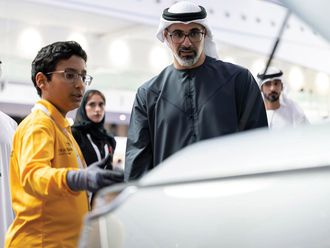
Speaking to Gulf News at the GIS Education Forum launched by Adec on Sunday, sixth-graders Majid Abdul Rahman and Abdullah Hassan who participated in this activity at the Bani Yas-based public school, Al Moatasim, told Gulf News: “We are very eager to use the computer and other electronics during our classes now. Technology has made learning easier and more fun for us.”
Both pupils expressed an interest in becoming engineers after they began using GIS at school.
Meanwhile, Alia Al Muhairi, Rama Bade’e and Halima Abdullah, aged 11 and 12, who worked on the artificial falcon’s nest exercise said that preserving this endangered animal is important to maintaining UAE heritage.
“They do not always know how to build their own nests so we must help them. Using GIS we developed a deeper knowledge of and interest in environmental conservation of this precious bird. We can access key information such as areas with food density, and identify empty and full nests using colour coordination. It is amazing to see how easily this can be done all the way from Abu Dhabi,” the girls said.
Adec plans to expand this initiative across all public schools in Abu Dhabi in the future.


