BE CREATIVE, MAP DUBAI CREEK
Residents help create interactive map
Dubai Here’s your chance to map the Dubai Creek. Residents and tourists are being encouraged to identify their favourite spots and share their experiences in the Al Fahidi historic neighbourhood on a massive map displayed at the Heritage House. Launched by the British Council, Dubai Culture and Arts Authority and the Sharjah Art Foundation, the mapping exercise continues until January 31.
Rachel Ireland, Acting Deputy Director of British Council, UAE, said: “Mapping Dubai Creek is a cartography exercise for residents to creatively map Dubai Creek and its surrounding areas. The result will be an interactive map that highlights places of importance to community members.”
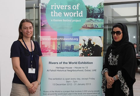
She said the exercise is a wrap-around activity for a larger project called Rivers of the World led by the UK’s Thames Festival Trust. The seven-year-old project links around 2,000 children from across the world each year to develop artwork based on the study and appreciation of prominent rivers. The mapping of the Creek is extended to everyone.”
Priya Nandagopal, Project Manager, Schools Education UAE, said: “This is a personal exercise to promote the significance of the Dubai Creek.” She said high resolution geo-spatial pictures of Dubai Creek have been printed on four canvasses that have been mounted in one of the Heritage House rooms. Anyone can identify a favourite spot on the map and make a remark on an index card, which is then pinned to the map.
The Rivers of the World project this year is seeing the participation of six schools from the UAE nominated by the Ministry of Education. Maisa Al Osaimi, a teacher from the Nad Al Hamar School in Dubai, said: “Ten students worked on a water colour artwork depicting what they saw and felt at the Dubai Creek. The result was a huge collage of a bird artwork.”


