China uses satellite positioning to map tiny plots
The mapping will replace current property deeds
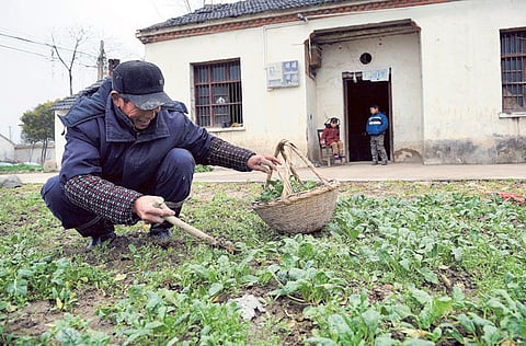
Yangwang Village, China: The bare light bulbs, unheated rooms and elderly residents of the whitewashed village of Yangwang in eastern China make it seem an unlikely place for an experiment in cutting-edge satellite technology.
This tiny village in Anhui province was home to a pilot project that for the first time mapped farmers’ land holdings, putting it on the front line of China’s efforts to build a modern agricultural sector that can underpin the country’s food security — a policy priority for the Communist Party.
The mapping is a tedious but crucial task to make farmers feel more secure about their rights so that they become more willing to merge fields into larger scale farms. It could also help protect them from land grabs by local officials, a leading cause of rural unrest.
“If we don’t do this now, and the older generation passes away, the next generation won’t know which plot is whose,” said Pan Shengyu, who oversaw one of Anhui’s land titling pilots.
“Soon no-one will be able to figure it out.”
China’s annual rural policy document released recently calls for title to farmland to be defined nationwide over the next five years. It is a technical challenge that could cost $16 billion (Dh58 billion).
In another move aimed at the countryside, Beijing unveiled sweeping tax reforms last week to narrow a wide income gap between the urban elite and rural poor.
Reforms in the 1980s assigned farmland to households but reserved formal ownership to the village collective. But land certificates are imprecise at best and over half of rural households lack some documentation — leaving possession dependent upon villagers’ knowledge and officialdom’s whims.
Lessons learned using satellite positioning to map tiny plots of land in Yangwang have been scaled up in other pilot projects in Anhui and elsewhere, with an eye to rolling out the programme nationwide.
Most Chinese farmers till about 8 mu (15 mu = 1 hectare) per household, an area roughly the size of an American football field. Each household’s land tends to be sub-divided into five or more separate plots.
Anhui Province alone has 100 million plots of less than 1 mu each. Nationwide, well over one billion plots have never been mapped properly.
The mapping will replace current deeds that often rely on descriptions like “Yang’s field borders Wang’s to the east” — an imprecise formulation that makes villagers reluctant to remove the dirt berms that separate each plot for fear they will no longer be able to identify what is theirs.
The information will go to searchable centralised registries, allowing farmers to confirm what they own and giving officials better land-use information.
Although China legalised transfers in 2008 to formally allow villagers to aggregate land, most Chinese agriculture is still too small-scale to permit investment to boost productivity enough to feed a growing urban population.
Those who rent large tracts of land are more likely to invest for the long-term if the transfer is documented and legal, a World Bank study found last year.
Farming families who feel secure in their land rights send more members out to find paid work, the study found. Monthly incomes for migrant labourers in cities exceed the amount earned in a year from a 1-mu plot.
More precise title “makes people feel more secure,” said Jian Zongzhu, a stooped 72-year old in Yangwang with bleary eyes and thick labourer’s hands.
“Everyone’s gone out to work but with a certificate you know the land is yours, no one can take it away and you can claim it back if you want. That’s important to common people because our life comes from the land.”
Costly
Assigning title is painstaking work that involves correlating satellite pictures with villagers’ records, issuing certificates and creating databases to register and search land transfers.
A flat field in the North China Plain may be sub-divided many times. Hilly south China terrain increases the satellites’ error margin. Trees hide field boundaries.
International Land Systems, a company acquired by Thomson Reuters in July 2011, was involved in the initial pilot project in Yangwang, which sought to find the most cost-efficient mapping method.
China’s top rural policymaker Chen Xiwen estimates costs could be kept to 8-10 yuan (Dh4.7-Dh5.8) per mu, or about 18 billion yuan nationwide. Other officials said costs could reach 100 billion yuan while respected financial magazine Caixin said it would cost 150 billion yuan.
Even the minimum would be too much for budget-strapped rural governments. A pilot in Anhui’s Matou Township, where flat wheat fields are cheap to measure, would have equalled one-sixth of its annual budget.
“Land certification needs to be shouldered by the nation, there is no way local governments could pay for it,” Matou Township vice-chief Wang Hong said.
The project carries a hidden price tag for Beijing, which subsidises grains production, fertiliser use and irrigation at an average rate of 150 yuan per mu. The subsidies are based on acreage estimates that date from when farmers regularly under-reported to avoid grains taxes.
Precise mapping could force China to reassess estimates it has 1.8 billion mu of farmland — or roughly the amount that Chinese experts believe is necessary for food security.
Matou Township alone gained 45 per cent more registered acreage with the more accurate mapping, to the delight of township officials and residents hopeful that greater subsidies will follow.
Some efforts to drive down costs as the project goes nationwide could themselves prove costly. Cheaper satellite positioning systems might be less accurate and software that fails to integrate future land transfers would make the mapping exercise a waste.
Replacing the pilots’ lengthy village-to-village explanations with a state media campaign might be quicker, but could alarm villagers suspicious after decades of state-backed land grabs.
Yangwang villager Yang Changpei worried he’d lose his land when he first heard about the programme. Careful explanations soothed his fears, although he didn’t see the point of clearer certificates when villagers all know each other.
His neighbour Jian, by contrast, was enthusiastic.
The berms that villagers use to identify their plots could disappear when fields are merged, leaving villagers in need of some other way to prove what is theirs, Jian said.
“If you explain it, people across China would understand how important this is.”

