UAE’s road infrastructure: All you need to know
Read the UAE’s road signs to never get lost again
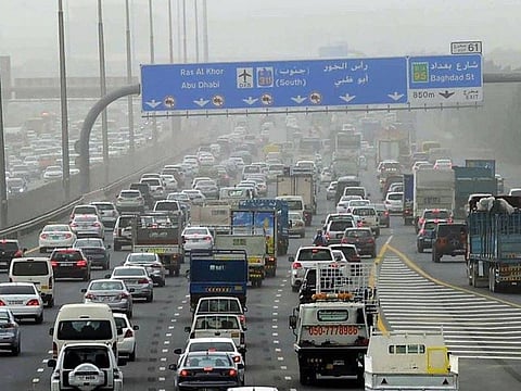
Dubai: The UAE has one of the most advanced road infrastructures in the world. The country's roads ranked number one in the world in the Global Competitiveness Report, issued by the Word Economic Forum for 2017-18 and the quality of the infrastructure is one of the most distinctive features that set the UAE apart.
However, while driving on UAE roads, you might struggle with finding your way or witness someone suddenly swerve to catch an exit on the highway.
The numbering system in the UAE is actually quite informative and now you can put your GPS assistant on the side (for some time at least) to discover the UAE's routes and navigate them using road signs. Here is all you need to know.
The ‘E’ roads
The major highways in the UAE are given the prefix 'E' for Emirates.
Even though the name of a road can change over a journey, this distinct street code remains the same, making it easier for you to navigate on road trips.
If you are in a new emirate and unable to find your way back home, look for a road with a blue road sign and an E in a falcon emblem.
Three roads – E11, E311 and E611 run parallel to each other and depending on whether you would like to go into certain city areas or drive on a relatively clearer route from one emirate to the other, you can choose which route you wish to take.
1. E11
This is the longest road in the UAE – stretching over 558km – and it goes through every emirate in the UAE except Fujairah. It stretches from Al Silah in Abu Dhabi and ends in Ras Al Khaimah. The road itself take various names like Shaikh Maktoum Road in Abu Dhabi, Sheikh Zayed Road in Dubai and Shaikh Muhammad bin Salem Road in Ras Al Khaimah but the E11 code remains the same. This route goes into the heart of the cities, connecting motorists to Abu Dhabi’s international airport or Dubai’s Bur Dubai area or Sharjah’s Al Majaz area. This is also, apparently, the best road to drive on for Abu Dhabi residents!
This is the route with the most toll gates in Dubai, as well. Starting from Al Barsha toll gate, the route takes motorists through the Al Safa toll gate and the Al Garhoud toll gate, with the final one at Al Mamzar, leading into Sharjah. Tolls, referred to in Dubai as ‘Salik’, are charged at Dh4 each time motorists pass under a toll gate and vehicles are required to have a Salik tag with the amount deducted electronically from individual Salik accounts.
2. E311
This road was named Shaikh Mohammed bin Zayed Road in 2013, before which it was referred to as Emirates Road. In 2016, a massive extension of this road took place, adding a 62km stretch, which is named Shaikh Mohammad Bin Rashid Road. This route starts at Al Shamkha in Abu Dhabi, trails through the outer city areas in Dubai, like Arabian Ranches, Silicon Oasis and also connects to the populated area of Mirdif. The route then goes into Sharjah and is one of the most used routes, as it provides Sharjah and Dubai residents toll-free access. Next, the route moves into Ajman and Umm Al Quwain, to ultimately merge with E11 in Ras Al Khaimah.
3. E611
Earlier known as Bypass road, E611 was renamed Emirates Road in 2013.
This route is 110km long and, as the name suggests, bypasses most of the busy city areas, running from Abu Dhabi, through Dubai, Sharjah, Ajman and Umm Al Quwain, to Ras Al Khaimah.
4. E84
A new 40-km long highway was opened in 2011 to connect the emirates of Dubai and Fujairah, shortening the distance by 20-30km as opposed to older routes.
5. E44
If you want to traverse this route end to end, better keep your passport with you.
This is one of most used highways in Dubai, essentially connecting the city of Dubai to Hatta, which is also part of the Dubai emirate. This route is known as Al Khail Road, Ras Al Khor Road, Al Aweer Road or Dubai-Hatta highway depending on which stretch you are driving on. It essentially starts from the junction where E311 runs along Jumeirah Village Triangle and Dubai Sports City. The route then runs through important new developments in Dubai, like Dubai International City and Ras Al Khor industrial area, crossing other important highways like E66, E311, E611 and E77. The road then enter’s Sharjah, running along the Al Madam area to briefly enter Oman’s territory. You will need to present your passport at the immigration point, and after driving through Oman for around 10-15 minutes, you will once again enter the UAE’s territory, into Hatta.
6. E66
This road which was earlier known as Dubai-Al Ain road was renamed Tahnoun Bin Mohammad Al Nahyan Road in 2018. It provides an important link between the cities of Dubai and Al Ain (which is part of the emirate of Abu Dhabi). If you track this route on the map, it starts from the junction where E11 runs along Dubai’s Wafi City mall and Healthcare City. After running perpendicular to other ‘E’ routes like E44, E311, E611 and E77, the route ends in the city of Al Ain, near the Al Hili area.
7. E77
Starting at Interchange no. 7 on E11, in Dubai, the Dubai-Al Lehbab road runs southward, providing another route connecting Dubai and Hatta. It intersects with E66 and eventually merges with E44 at Al Lehbab, which is an area in Dubai just before you would enter Sharjah.
8. E55
This is a route that provides a connection between the northern emirates and Abu Dhabi. Starting from Umm Al Quwain, this route weaves it way through the Sharjah- Umm Al Quwain border, intersecting with six other ‘E’ routes, to enter Abu Dhabi and merge with E66, near the UAE-Oman border.
9. E10 and E12
These two routes connect E11 to various parts of Abu Dhabi. The starting point of E10 is a branch off of E11 at the popular Emirates Park Zoo in Abu Dhabi and it runs through Khalifa City, ending in the heart of Abu Dhabi’s residential area.
E12 provides a more scenic route, branching off of E11 at the Al Reef area in Abu Dhabi and stretching across Yas Island, Al Jubail Island and Saadiyat Island to end at Zayed Port. This is the route you need to take to visit the popular Yas Marina circuit or Louvre Abu Dhabi.
10. E20, E22 and E30
These three routes start close to the Shaikh Zayed Grand mosque. While E20 and E22 start from either side of the iconic structure, E30 starts a few kilometers later.
E20 connects the internal areas of Abu Dhabi, intersecting with other major routes like E11, E75 and E16. It starts from the Al Maqta'a creek in Abu Dhabi runs along the Zayed University area, and joins E66 just before the Oman border.
E22 also starts from the Al Maqta'a creek and is named Abu Dhabi-Al Ain road. Running through the Al Mafraq and Al Wathba areas of Abu Dhabi it end close to the Al Ain international airport.
E30 runs parallel to E22 for a large part of its stretch, connecting the Al Maqta'a area to the popular family destination of Green Mubazzarah in Al Ain.
11. E13, E16, E45, E65, E75
These routes connect the coastal routes and cities to the internal region, providing access to areas like Bateen Liwa, Hameem and Asab.
12. E14
This route connects E11, from the Al Ghantoot area in Abu Dhabi to E66 close to the Oman border.
13. E18
This route stretches the north eastern part of the UAE, starting from E11 in Ras Al Khaimah, weaving through Sharjah, Fujairah and Ajman, to join E88 in Fujairah.
14. E90 and E95
These are two major roads that stretch the internal borders of the UAE. While E90 runs along the southern border with Saudi Arabia, E95 runs along a large part of the eastern border with Oman.
15. E15, E40, E45 and E65
These routes connect the coastal E11 to the internal E90 and E95, passing through many internal areas.
16. E77
This route was earlier known as Jebel Ali – Al Lehbab road, connecting the two parts of Dubai. However, it was renamed Expo Road this year as it connects to the EXPO 2020 DUBAI site.
17. E88
This is a crucial road for people in Sharjah as it connects a lot of the internal areas in the Emirate. Also known as the Al Dhaid-Masafi road, it starts from where E11 runs through the Cultural Square in Sharjah. It then runs along Sharjah International Airport and Sharjah National Park to end in Al Dhaid.
Understanding Dubai roads
Internal roads in Dubai are named differently but it is helpful to understand the route code rather than the road name to figure out where exactly you are in the city. For example, did you know that if you are on a road with an even number, you are running parallel to the coastline, effectively moving along roads that connect Abu Dhabi to Sharjah through Dubai? Here’s a breakdown of all you need to know about Dubai roads:
1. All internal routes start with ‘D’
All roads within the UAE are given the prefix ‘D’ for Dubai and the route code is within a green fort, resembling the old architecture of the country.
2. The number is not random
The numbering of Dubai roads is meant to provide additional information to the motorist. D-Routes parallel to the coast are numbered evenly starting from D94 and decreasing as one goes away from the coast whereas, D-Routes perpendicular to the coast are numbered odd and the number increases as one moves from Abu Dhabi to Sharjah.
3. The ‘Exit’ tells you more than you know
Exit numbers in Dubai were designed to make it easier for motorists to locate their position, especially in times of emergencies. Every exit from an E-route, whether to other E-routes or to D-routes, is assigned a number. This number increases in value as you move from the Abu Dhabi border to the Sharjah border. Exit numbers also tell you your precise location on the highway. For example, Exit 26 on E11 means you are 26 kilometres from Abu Dhabi border and, similarly, Exit 36 on E66 (Dubai-Al Ain Road) indicates that you are 36 kilometres from the sea.
This will help you plan your exit from a highway to your intended destination.
Other emirates
Similarly, in Abu Dhabi’s main city area, street numbers were introduced to make it easier for motorists to navigate. In 2015, Abu Dhabi’s streets were given odd route numbers in one direction, and even numbers in the other. This numbering system can also be observed in Ajman.


