Deadliest earthquakes in the Philippines: What you need to know
28 tremors recorded daily in the country on the edge of the "Ring of Fire"


Earthquakes frequent the Philippines, an Asian country of 108 million inhabitants. And this is because the archipelago (made up of 7,641 islands) is on the western edge of the so-called “Ring of Fire”.
There’s a fascinating reason why geologists attribute "fire" to it. The vast area is a seismically active site, which often triggers volcanic eruptions and tremors. Another fact: this area is home to 75% of the world’s 1,500 most active volcanoes. About 300 of those volcanoes are in the Philippines, of which 22 are active and the rest (278) are "dormant" as of the record.
Why is the Philippine frequented by earthquakes?
The reason is because it straddles a number of active earthquake fault lines. Faults allow blocks in the Earth's crust to move relative to each other. These movement may occur rapidly, usually in the form of an earthquake — or may occur slowly, in the form of what geologists describe as "creep". Most faults produce repeated displacements over geologic time.
What is a fault line?
A fault line is a fracture, or crack, along which the Earth's crust (thin shell on the outside of our planet) has moved. The relationship between earthquakes and faults was first established by nineteenth century geologists following the 1855 Wellington Earthquake in New Zealand.
Where do most earthquakes occur?
Most earthquakes occur along cracks in the planet's surface. These fructures may be small and localised or can stretch thousands of miles where tectonic plates meet. Within this ring, the tectonic plates are constantly jostling each other — sliding past, colliding into, or moving above or below each other. A result of these movements: deep ocean trenches, volcanic eruptions, and yes, frequent earthquakes. The tremors usually take place along fault lines, the boundaries where the plates meet. Seismologists now understand that all earthquakes occur on faults, with the exception of the deepest ones (at depths of 600-km).
How are these movements measured?
Seismic waves are generated when the two sides of the fault rapidly slip past each other. For most earthquakes, the faults do not break the surface, so the faults can be "seen" only through analysing the seismic waves. What causes the deepest earthquakes? Seismologists have yet to know the forces at play. At 600km, the earth is thought of as perhaps too warm for faults to be brittle, like glass, as seen on the planet's surface.
How many Philippine earthquake fault lines are there?
Here's where it gets even crazier. The country, which has a land area of about 300,000 sq km (smaller than California's 423,970 sq km) has not just one — but five major fault lines.
These fault systems are known as:
On Sunday, at 4.22 GMT a strong magnitude 6 earthquake hit the southern Philippines on Sunday. But the temblor followed an earlier one, at 4.8 magnitude an hour earlier, according to the US Geological Survey and local officials said.
The stronger quake struck the town of Bansalan on Mindanao island at 12:22 pm local time, the USGS said in a bulletin. The quake was recorded at a depth of 15.6 kilometres (9.7 miles), slightly shallower than at first reported by the agency. Civil defence officials in the region reported strong shaking.
How many earthquakes occurred in the Philippines in the last 30 days?
Unknown to many, hundreds of earthquakes are recorded each day in the country. Only some are occasionally strong. For a context of earthquakes in the Philippines, take note of these numbers. According to Volcano Discovery, which keeps tracks of earthquakes, in the last 30 days (January 7 to February 2021), the Philippines was shaken by the following:
Geologists explain that people don't normally feel quakes below magnitude 2. Many small-magnitude quakes occur regularly due to the meeting of major tectonic plates in the region. The strongest, at magnitude 8.3, occured in the 1918 Celebes Sea.
Within this fiery ring, the tectonic plates are constantly jostling each other — sliding past, colliding into, or moving above or below each other. A result of these movements: deep ocean trenches, volcanic eruptions, and earthquakes. The tremors usually take place along the boundaries where the plates meet, called "fault lines".
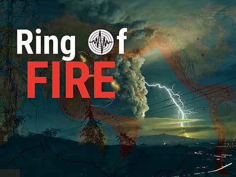
RING OF FIRE
The Ring of Fire, also known as the Circum-Pacific Belt, traces the meeting points of many tectonic plates, including the Eurasian, North American, Juan de Fuca, Cocos, Caribbean, Nazca, Antarctic, Indian, Australian, Philippine, and other plates, which all encircle the large Pacific Plate.
The Philippine Trench (aka Philippine Deep)
• This undersea trench, or active "depression" east of the Philippines, is a central part of an earthquake fault theorised to have formed during the Plio-Pleistocene times. • This trench has a length of approximately 1,320 kilometres and a width of about 30 km (19 mi) from the center of the Philippine island of Luzon trending southeast to the northern Maluku island of Halmahera in Indonesia. • At its deepest point, the trench reaches 10,540 meters (34,580 ft) — equivalent to the height of 12.7 Burj Khalifa towers.
What were the strongest, deadliest earthquakes in the Philippines in recent memory?
One of the strongest earthquakes to ever strike the country in recent memory occurred in central Philippines, in 2013. It was the 7.2-magnitude tremor which resulted in a total of 150 deaths and serious damage in properties. The tremor affected more than 3 million families in Central Visayas and destroyed century-old churches. But it was not even the deadliest tremor the country had ever seen. Another was the Mindoro earthquake which swept away 1,530 houses in the coastal areas of Baco and Calapan, Oriental Mindoro after a tsunami kicked up by the earthquake.
The 5 deadliest earthquakes in the Philippines had been document in the 20th century.
How do earthquakes trigger tsunamis?
At the Earth's surface, earthquakes manifest themselves by shaking and displacing or disrupting the ground. When the epicenter of a large earthquake is located offshore, the seabed may be displaced sufficiently to cause a tsunami. Earthquakes can also trigger landslides and occasionally, volcanic activity.
Why are dormant volcanoes dangerous?
Many of these so-called "dormant" volcanoes had been drilled for geothermal power (25% of world's generation capacity). However, the adjective "dormant" can be a bit unreliable, even deceptive. Example: Mt Pinatubo was considered dormant forever — until had a cataclysmic eruption in 1991, massively damaging communities around it (and kicking out 2 US military bases, the world's largest such facility outside America, nearby).


