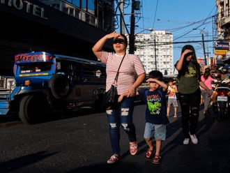
Manila: The Philippines braced for the arrival of Typhoon Utor on Sunday as a warning for the strongest storm to hit the country this year was issued.
Six provinces have been placed under storm signal No. 3 on Sunday as typhoon Utor cut across northeastern Luzon towards the northwest bringing winds up to of 150 km/ph in its path.
Utor, (Philippine codename “Labuyo”) is the 12th weather disturbance to hit the country and is expected to be the most powerful for this year as it is expected by the state weather bureau PAGASA, to reach anywhere between 7.5 to 25 millimetres per hour (or heavy to intense rainfall) within a 600 kilometre diameter expanse.
“The typhoon is expected to make landfall in the north-eastern agricultural province of Aurora early morning on Monday, he said, adding that heavy rains are likely to cover a larger area including the capital Manila.
Utor, moving west-northwest at 19 kilometres per hour, was forecast to dump up to 25 millimetres of rain an hour within a 600-kilometre diameter of the typhoon, the bureau said.
“Residents in low lying and mountainous areas... are alerted against possible flash floods and landslides,” it stated in an advisory.
The bureau also warned seafarers to remain at port due to strong waves, as the police, military and emergency relief authorities were placed on high alert.
The Philippines is hit by about 20 storms and typhoons each year, some of them devastating.
Nearly 2,000 were killed or went missing in flash floods and landslides when Typhoon Bopha cut across the southern island of Mindanao in December last year.
About 850,000 people were also displaced, and many of them remain in temporary shelters months after the typhoon.
The Hong Kong Observatory had classified Utor as a “severe typhoon” on its website on Sunday.
— With inputs from agencies