Manila: The UN Food and Agriculture Organisation (FAO) is using drones in Iloilo to survey the extent of damage caused by the El Nino to farms in the Central Philippines’ Visayas province.
According to FAO Representative in the Philippines José Luis Fernández, drones or Unmanned Aerial Vehicles (UAVs) are being flown over Iloilo to conduct aerial assessment and gather data that would be useful for disaster preparedness and response efforts.
“Closely observing the extent of damage experienced in the province could help technical experts in determining areas for improvement in the drone mapping methodology that is currently being developed by DA (Department of Agriculture) with the support of FAO,” said Fernández.
Initially used for military applications from the mid-1990s, drones, which are basically eyes in the sky, are being increasingly used for peaceful purposes and recreation.
Mapping the extent of damage and effect of the El Nino will help farmers and residents take action to offset the effects of the drought.
According to the Philippine Atmospheric Geophysical and Astronomic Services Administration (PAGASA), the country is expected to experience El Nino from March to September this year.
Other than the province of Iloilo, other areas that have already been affected by the weather phenomenon include Cebu, provinces in the Zamboanga peninsula, Cotabato and Maguindanao, as well as Puerto Princesa City in Palawan.
The effects of the El Nino in Cotabato and Davao provinces have led to violence in Kidapawan City after farmers and their supporters blocked a major highway prompting authorities to call for police assistance. Two demonstrators were confirmed dead and dozens, including policemen, were injured in the melee.
El Nino, which means young boy in Spanish, refers to the El Nino Southern Oscillation and pertains to the cycle of cold and warm temperatures experienced in the Eastern Pacific. It is the reverse of the La Nina, which countries in the same area in Eastern Pacifc also periodically experience.
According to the agriculture department, more than 25,000 hectares of agricultural areas in Iloilo have already been affected by prolonged dry spells. Initial assessments also indicate that the province has the largest number of farmers struggling from the impacts of the current El Niño.
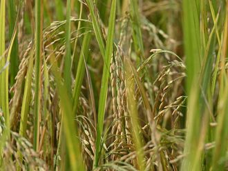
The FAO said that in Passi City, rice farmers have reported experiencing as much as a 75 per cent drop in harvest during the last cropping season.
It said that data-rich maps generated from drone flights in Passi City and Pototan Municipality will allow DA technical specialists to provide sound and evidence-based recommendations. The two-day mission covered approximately 800 hectares.
“This exercise serves as a litmus test for the drone protocols for aerial risk and damage assessment that we have developed over the past year and are continuing to improve. The information we gather here will be useful for immediate and medium-term planning, and can facilitate better-informed decision-making on how we respond to crises and at the same time improve disaster preparedness among farmers,” Director Christopher Morales of the DA Field Operations Service said.
“Employing modern technologies and scientific tools will be instrumental in achieving our anti-hunger and poverty goals, especially in the most vulnerable agricultural areas,” Fernández for his part, added.
The FAO has been supporting the Philippine government’s Disaster Risk Reduction and Management agenda since 2009. The UN agency had earlier distributed stress-tolerant rice varieties and taught farmers and fishermen risk-reducing practices.


