KATHMANDU: It’s not such a simple question.
In the past, geologists have disagreed about what to include in their calculations: Should the summit’s snowcap be included? Or should surveyors drill down to the peak’s rock base?
What about the recent earthquakes in Nepal, which geologists believe shrunk the mountain by about 3 centimetres?
Challenging task
Then there is the challenge of geography: Reaching the summit of Everest is only possible a few weeks each year, and measuring the mountain’s height from sea level has presented difficulties in the past. (Nepal is landlocked).
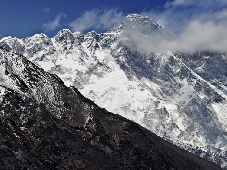
Today, Everest’s height is widely recognised as 29,029 feet. But teams from around the world, including China, Denmark, Italy, India and the US, have come up with other calculations.
These measurement expeditions have typically excluded experts from Nepal, which shares the mountain with China.
Now, for the first time, Nepali surveyors are limiting intervention from foreign powers and sending a team to the summit to settle the height question for themselves.
First recorded attempt
In the mid-19th century, when Nepal was closed to outsiders, a team hired by Sir George Everest, a former surveyor general of India, assembled near India’s border with Nepal. It was there that Radhanath Sikdar, a young Indian mathematician, and a group of so-called human computers, used triangulation to collect data on the mountain, known then as Peak XV.
In 1856, the height of Peak XV was recorded at 29,002 feet. But Sikdar’s contributions were pushed to the footnotes, and Peak XV was eventually renamed in honour of George Everest.
About 100 years later, when Nepal cracked open its borders to foreigners, scientists moved their measurement tools closer to the mountain, which lies partly in Tibet. In the mid-1950s, the height was recognised as about 29,029 feet, making it the world’s tallest mountain above sea level.
(By one measure, the world’s highest peak is actually Mount Chimborazo in Ecuador. The summit, an inactive volcano in the Andes, rises about 20,500 feet above sea level, far short of Everest. But because of the globe’s bulge at the equator, it’s a different story when you measure from the center of Earth: Chimborazo’s apex then rises at about 21 million feet or 3,967 miles.)
Up and down
Roger Bilham, a geologist at the University of Colorado Boulder, said Everest’s location in the zone of compression between southern Tibet and India means it sinks during earthquakes and rises in the period between them. A major earthquake in 1934 lowered the mountain 63 centimetres, or about 2 feet, according to data provided by Bilham.
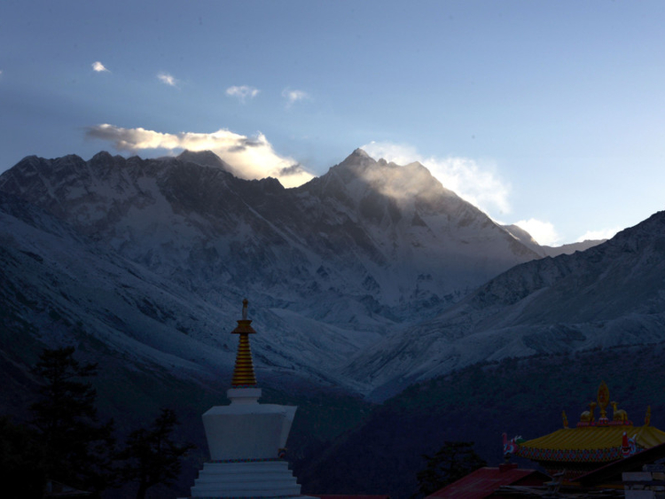
The other side of Everest
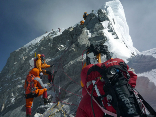
Poor regulation and overcrowding are pushing Everest climbers away from Nepal to China, which is investing millions to boost a rival path to the top of the world.
Veteran climbing outfits, fed up with what they regard as a lax attitude to safety on Nepal’s southern flank of the 8,848 metre (29,029-foot) peak, are starting to shift operations to Everest’s north side in Tibet.
“The south side is way too overcrowded with inexperienced people,” Phil Crampton, a seasoned Everest hand who announced in January his company Altitude Junkies would shift to China, the third such outfit to abandon Nepal in recent years.
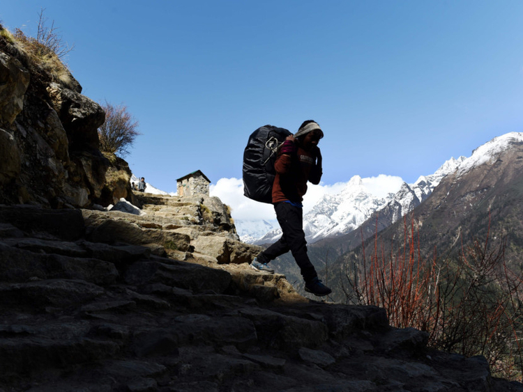
A growing chorus of foreign-led Everest operators in Nepal are demanding greater scrutiny of low-cost outfits that have mushroomed in recent years, offering cheap expeditions up the fabled summit.
These budget players are luring hordes of amateur climbers chasing the thrill of Everest but also risking death and injury, climbing experts say, warning that some expedition leaders are ill-equipped to tackle the peak.
Seven of the 10 climbers who died on Everest’s south in the last two years were summiting with budget operators, according to information from the Himalayan Database.
“What has happened over the last few years on the south side is absolutely intolerable,” said Lukas Furtenbach, whose company Furtenbach Adventures relocated to China last year citing safety concerns.
Those pushing for change want to see permit numbers curbed and greater oversight of guides and operators.
“Nepal needs mountaineering rules and regulations. But for the operators, not for the climbers,” said Furtenbach.
Nepal has been criticised as reluctant to introduce much-needed regulations because it fears harming an industry that spins money for the impoverished nation.
Nepal’s tourism department, which oversees the mountaineering industry, defended its position on Everest safety.
“We cannot respond to every comment people make. Every year we have more people coming to climb Everest,” said department head Dinesh Bhattarai.
What is China doing?
It is sending a message that Everest’s north is open for business, investing in climbing infrastructure vital for a safe ascent to the summit.
It is building a mountaineering training centre in Lhasa and plans to allow helicopter rescues on Everest’s north from 2019, according to Chinese state media. Currently helicopter rescues are only possible in Nepal.
“China is addressing the issues in a way that Nepal has just struggled to... There is no system in place to actually enforce the rules,” said Adrian Ballinger, who was the first operator to move exclusively to Everest’s north in 2015.
Until a decade ago, a roughly even number of climbers attempted the summit from the northern and southern sides of Everest.
But China’s reputation took a hit when authorities closed the Tibetan side of Everest without warning in 2008, fearing protests ahead of the Beijing Olympics.
Many companies abandoned the north saying the political situation in Tibet was too unpredictable.
Peak facts
Italy (1992)
29,022 feet.
US (1999)
29,035 feet
China
29,017 feet
How is Everest’s height measured? In the 19th century, the height of Everest was calculated by measuring the angles between the top of the mountain and points on the ground whose positions relative to the average height of the sea were already known.
Now, surveyors place a global positioning system receiver on the summit ice for an hour, and mathematically calculate the height of the sea from satellites and measurements of gravity at the base.
Many Chinese adventurers also prefer Nepal as laws back home require they summit an 8,000 metre peak before trying Everest from Tibet.